Lincoln National Forest - Sacramento Mountains Loop Hike ( Forest Trails 109,110,111)


 This is City of Alamogordo land here and to the east for about 3/4 of a mile. I walked on the road beyond the gate to start, but the actual trailhead is about 1/10 of mile south on the road. The many acres of wet meadows full of wildflowers and tall grasses on view here makes the road the far more pleasant and scenic option and as far as I can tell there is no prohibition on walking through here. Please be respectful and don't climb any fences or try to investigate the several wells that have been tapped here because of the myriad of springs.

Eventually, I eased over onto the trail itself at a point when it was immediately adjacent to the road and soon after I came to the intersection with FT 111, my return route. For a short way FT 109 was a pleasant shaded single track but when it reached the Forest Service boundary, it turned back into an old road (like many LNF trails).

 Now the climb began. Luckily, it was well shaded all the way to the junction with the Pipeline Trail. At that intersection I remembered from a hike more than 10 years ago there was particularly large Douglas-fir along the trail to Alamo Peak. I kind of wanted to see it again and began hiking up the now significantly steeper FT 109, instead of making my turn onto the Pipeline Trail in hopes of seeing it soon. It wasn't soon enough though. I changed my mind, and went on up and to the southeast on FT 110 listening to the water quietly trickling in the steel pipe when I wasn't being deafened by flights from Holloman AFB.
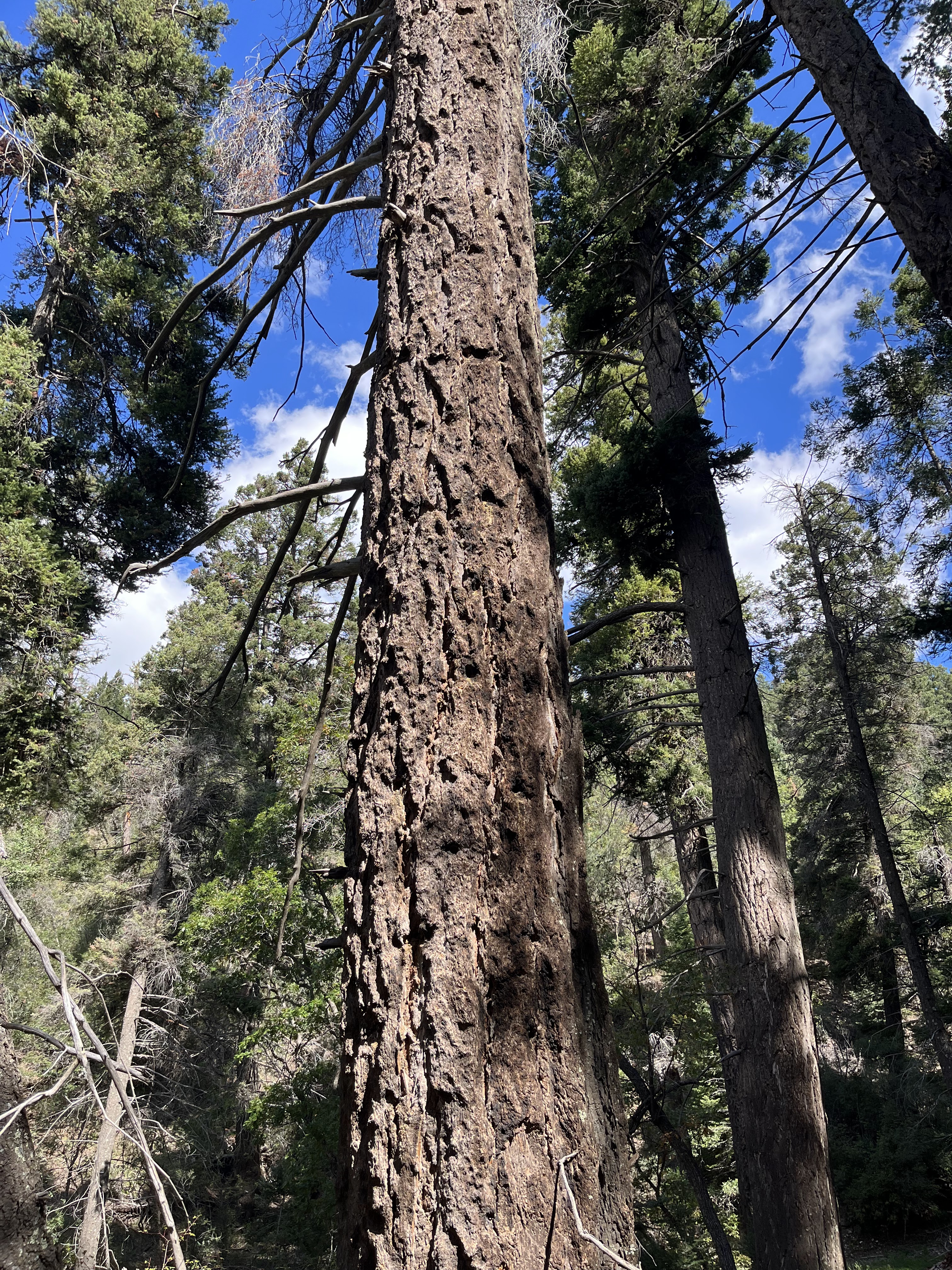
  Happily, when I arrived near concrete trough full of water at the start of the pipe which is a conduit for spring water from a small drainage, there was another stand of big timber, that I had completely forgotten about. Several of these trees had diameters approaching 4 feet and one that had died in recent years ( it appeared) was in excess of 50 inches wide.

 The Pipeline Trail had the only open, sunny sections of this hike. It was little hot, but the views, down to the meadows where I had started and to the sedimentary rock of the hills and canyons beyond, were fantastic.

After enjoying my lunch it was a short walk to the top of the ridge where the intersection with the Rim Trail and Atkinson Field trail ( FT 111, the beginning of which is buried in downfall). It was downright cool even in the sun at 9000 feet elevation.
 The climb had brought me up about 1800 feet, but now it was time to go down, so down I went. At first it was a nice walk on an extension of the ridge. Where the trail jogged to right I saw several elk. Soon after that though, the trail became a contour cutter in the vein of the Heart Attack Trail and Upper San Andres Trail. Like the Heart Attack Trail ( FT 235) it seemed to owe its existence to the initial era of dirt bike enthusiasm and not to those interested in traveling on foot. Sure enough to confirm this idea, I eventually spied a bright red piece of plastic that when I turned it over was indeed a lost motorcycle fender.
A few words of warning about the Atkinson Field trail are in order here. If you do this loop make sure it is the downhill portion, the only thing less pleasant that going down it would be going up it. Personally, if I were to hike in this area again, I would skip it altogether. With the exception of a short, very narrow, tunnel like passage with a few mature bigtooth maples, it is not that scenic.

 It is a dark, damp corridor with no views best suited to wildlife travel.The trees are small, and downfall is plentiful. It may have some fall color with the maples, but there are many more preferable places to walk if you want to see pretty autumn leaves. In most of the middle section, the trail and the rocky ravine are one. The rapid descent in what is little more than a ditch was hard on knees, ankles and feet. I never fell, but if it is wet at all, you can count on it.

At the bottom where the trail leveled out and separated from the watercourse, it did become a sweet walk among mature ponderosas, grasses and wildflowers, but this is a very short (< 1/4 mile) part of the trail.
Re-united with FT 109, I rested on log, ate a few more snacks, took a few more pictures of the meadows, and then continued back to the road, this time using the actual trail ( which was definitely less nice than the way I went in. It was good to get out.


 |
| Alamo Peak |


posted by Devon Fletcher at
11:37 AM
![]()
![]()


0 Comments:
Post a Comment
Subscribe to Post Comments [Atom]
<< Home