Gallinas Creek - Gila National Forest


I started out this trip parking just outside the now closed Lower Gallinas Campground. I walked past the gate and down the fading two track. Nature is taking over here the last four years, and it won't be much longer before FR 984, and most other traces that there ever was campground here will be concealed by grasses, wildflowers, shrubs and weeds. The old outhouses will last for a long time ( if they aren't moved), but in the future folks might wonder about their placement.
It's bit sad, because Lower Gallinas was a lovely place to camp or picnic, as was the section of Upper Gallinas on the north side of the creek where we've stayed several times, also now closed. I will check with the Forest Service but it seems that both have no immediate plans to be reopened. I guess the old roads can still be used for nice little creekside walks.
I crossed the creek for the second time and followed the use trail past where road ended. Soon, the lowermost of Gallinas' three boxy sections began. It's easy to forget, but the most significant of the three, the middle one, starts just below Upper Gallinas Campground, and is where you drive your car on NM 152. That part of the canyon is so narrow that the stream is mostly hidden from view from the highway, but it can be hiked. It's a scramble in spots, but my wife and I made it through a few years back and discovered a rookery along the way. The upper box starts just past the confluence with Railroad Canyon. It is short and rugged with a few small waterfalls. I hiked it with Seamus two years ago. We got wet.
I walked down the shady trail and soon met a dog and then a woman who was setting up a wildlife camera. We chatted a bit and then I was on my way downstream. Many years ago my wife and I had hiked down this way and were stopped in our progress by an extremely narrow passage through the rocks and the six foot waterfall within. I remember little green and red toads covering the water worn boulders. Now I was at the same waterfall. The only way around was a sketchy line up to a short but sufficiently level traverse across the cliff on the north side. I went slowly and it worked just fine.

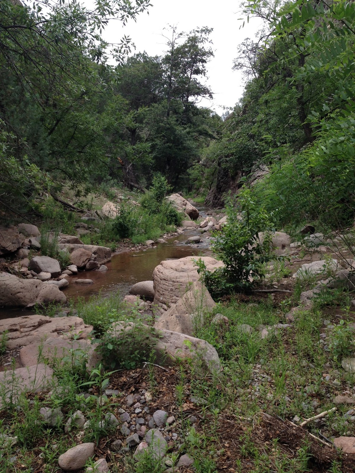
On the other side was a boulder strewn stream course with a lush growth of willows. Above towered bare formations of volcanic rock. Further down the canyon widened just a bit and there were walnut and alder trees, as well as the occasional massive old cottonwood.


A large cairn marks the spot where FT 795 goes up to the highway. In retrospect, because of the dicey little climb around the waterfall, this is probably the better option for most folks who want see the lower end of the canyon. Just as I was thinking how the little box I had just come through perhaps could be a site for restoring trout to the stream, the stream dimensions changed to 10 feet wide by one inch deep, the shading greenery retreated, and the cow patties appeared. I didn't have time to be disappointed too long, as the creek soon entered another narrow passage, and lo and behold there were fish in murky pools carved in the bedrock, not trout mind you, but shiners and small dace ( I think), but any kind of fish surviving here seemed like a little miracle. New Mexico Game Fish maps and pamphlets from the 1970's list this stream as having trout, but I think it's been a long time since anyone has seen one in there. I threw a few rocks in the deep pools, well, because you never know.
Past this section of the creek the valley opened up more.The riparian trees and even the box elders grew scarce. Just alligator junipers now, baking in the heat. Willows, growing well back of the current channel, were trimmed into shrubs. It was no surprise at all when I saw my first cows of the day, and contemplated turning around right then, but I trudged on down to the confluence with Silver Creek, which was running.
 |
| Confluence of Silver and Gallinas Creeks |
I looked around for spring that's in the vicinity but couldn't find it. I thought for several minutes about my original plan to head up Silver Creek and then up Bull Trap Canyon, and finally climb over the little mountain to hike back to Lower Gallinas. But, just getting to this point had taken longer than I had expected, and I didn't relish trudging up over the ridge, first, because it was warm and humid, second, because I didn't want to be up there when the inevitable thunderstorm hit, and third, because I was plain old tired. So, the walk became and out and back. I met a man on the way out. So that was a total of 2 other human beings and a dog encountered, which by Black Range standards nearly constitutes a crowd. I thought of the book No Life for a Lady when she mistakenly thinks the bear tracks she's looking at are those of a barefoot human. I had seen plenty of those same kind of prints in the mud throughout the day and bear scat as well. I gave the hiker a heads up. He probably resented it. People would rather not be reminded they're in bear country.
It had been a good day, but I was in store for a little more Gila magic. As I walked up the road, scoping out how to best climb that ridge for a future hike into Bull Trap Canyon, several of the creeks namesake "gallinas"(wild turkey hens) and about 20 chicks moved quietly through the tall grass directly in front of me. I moved slowly and they stayed calm going down along the creek.
Labels: camping, hiking, waterfalling
posted by Devon Fletcher at
2:13 PM
![]()
![]()


0 Comments:
Post a Comment
Subscribe to Post Comments [Atom]
<< Home