
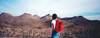

We've done a lot of exploring in the Dona Anas. One nice hike started out at the Chihuahuan Desert Nature Park. We hiked west along the side of the east-west running ridge immediately adjacent to the park and checked out an old copper prospect that has a lot of blue-green coated rocks lying around. Be careful here because the shafts are deep enough to injure yourself seriously. We then used the roads to go around the ridge,and completed the loop going cross country on the south side back to the nature park. We've also explored the mines and prospects in the Wagner Canyon area and the surrounding hills. One of mines is very deep and dark and still had a steel cable running down in it. Explore at your own risk. I've also have found my way to the Dona Ana's only legitimate gold prospect. It's not real easy to find, northwest of Cleofas Well, sitting in an anonymous ravine amongst low hills. There are a couple of shafts and trenches. I used to have some rocks from the meager tailings piles,but have since misplaced them. From what I've read the initial ore was very rich,but extremely limited in extent. It has been in this range where I've managed to end up in a tight spot with my old 2 wheel drive Izusu Rodeo on more than one occasion, but managed to extricate myself each time. Many of the roads in this small range aren't really roads, but trails suitable for Jeeps, dirt bikes and ATVs. This type of travel is the main recreational use of the mountains. Unfortunately it has led to a concentration of created roads and trails in certain areas which not only mar the scenery,but also diminishes other wild land values as well. There are also some well known rock climbing walls in the Dona Anas and you may see some folks enjoying this sport. One time we watched several climbers on a formation called the "Towers." Note: as with my most recent blog about the Dona Anas, the "Towers" and other areas mentioned here may be off limits now. Check with NMSU and BLM regarding accessibility.
Labels: hiking, Organ Mountains/Desert Peaks National Monument


8 Comments:
I wish you would contact me about caves and rock art around las cruces. My name is Jeff jkaake@elp.rr.com
Hi Devon,
I'm looking to bring a video crew to Southern NM at the end of March/early April to film some footage for an outdoor cooking program. We're looking for some lush green scenery like in your 2010 posts - Bonita Lake, South Fork Bonito Creek, Tularosa Creek.
Do you have any recommendations on areas that would be lush and green in S NM that time of year and that wouldn't have snow cover?
Best Regards,
Sherie
That really isn't a good time of year for lush and green as it's at beginning of our dry windy season. Higher elevation areas are still pretty cold with little growth. If the winter continues to be wet, lower elevation mountains may green up nicely before drying out in April and May.The Sacramento Mountains around Cloudcroft and High Rolls may be your best bet( if not covered in snow from a March storm).
Most of those photos are taken in June or July. I did and April hike last year in San Andres Canyon and it looked pretty nice, the spring was flowing, the maples had leafed out and there was even a little bit of grass. If you can wait, I'd shoot for later in April.Check out the Osha Trail hike in my Archives for what the area looks like in the third week or so of April.
Thank you for your input Devon!
I forgot to mention, because it's a rarity, but if we continue to get winter rain, the desert areas right around here in Las Cruces green up, and we get wonderful wildflowers- especially california poppies.
I have been unsuccessful in 4 attempts to find the Petroglyphs at Rincon (I-25, Exit 35). I have driven both east parallel to the railroad tracks and also North to where the trail ends for vehicles. Please help me in getting to the Petroglyphs for photos. I have read your entry and DScott's entries and am still confused. Hoping to hear from you shortly,
Steven Lotkin
Las Cruces, NM
stlotkin@yahoo.com
From the Rincon exit, head east for about 1/4 mile( parallel to the big wash and railroad tracks) then turn north on the rough road.Drive 3/10 of a mile to the large barite mine excavation and park. Hike northwest on the road out of the barite mine for around a 1/4 mile as it circles around a rocky hill with small mine tunnels. On the north side of the hill below you is the canyon with petroglyphs. You should see some cave like alcove across from where you stand. Images are both upstream and downstream from this point.
Post a Comment
Subscribe to Post Comments [Atom]
<< Home