Organ Mountains-Desert Peaks National Monument - Sierra de las Uvas
 |
| Sierra de las Uvas |


 |
| Agate/chalcedony brought by crow or raven (or maybe a human) |


 |
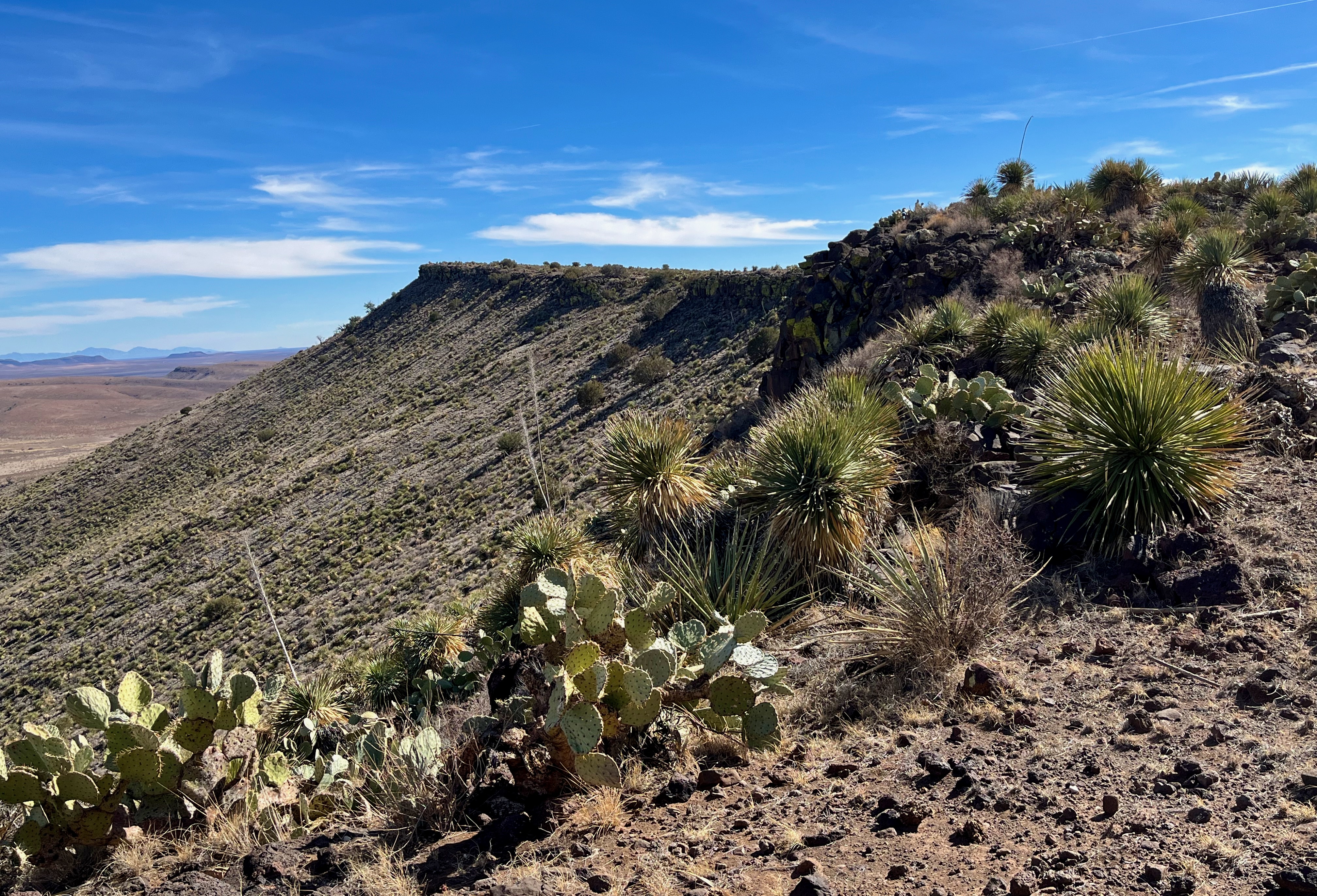
| Massacre Peak at right. |
 |
| Florida Mountains in the distance |
 |
| Cooke's Peak in the distance |
There aren't many more places I want to explore left in the Sierra de las Uvas. Most of the ones that remain are difficult of access due to poor roads or private inholdings or both just to get to a point for starting off a hike.These planned hikes too, look to be longer and more difficult than what I've been used to these last few years. This one that I did a few weeks ago was not too bad. The roads were good up until a half mile stretch that immediately preceded getting to my parking spot. This was a truly un-maintained, rarely driven little path that will cease to be a road at all in the not too distant future. We made it alright by driving very slowly and carefully.
I was looking to explore a mesa and the canyon that cuts through it, at the very northern end of the Apache Flats valley. Neither has a name. The canyon is a tributary of the large canyon that runs to south of and is a tributary to Pine Canyon, the largest upland canyon on the west side of the Uvas.
I started off to the east and then began the steep pitches to get to the mesa rim. It's bit a strange feeling to feel like you've climbed a little mountain only to be looking at a valley when you get to the top. Such is the topography of the Uvas. I found some petroglyphs on isolated boulders a few years back not too far from this little canyon, and truthfully the hope of finding more, or other types of evidences of ancient peoples was the only driving factor in exploring this area ( and most of the other areas left to explore in the range) in the dead of winter. I say this because the landscape is so desiccated, abused, forlorn and uninspiring right now it's stands almost in defiance of deriving the those good feelings we all seek when getting outdoors.
I meandered down the valley. Three young deer and I watched each other for awhile. There were a couple of playful calves and then their bellowing moms encountered as I marched down their trail as well. The side canyon cliffs had both living and skeletal junipers straightening toward the sun. In the main canyon they grew large and globular. Every plant seemed to be an overcooked green. The dark cliffs and boulders were devoid of rock art. Every step was a scrape or a crunch. At one point I happened upon a colorful hunk of jasper, a tiny bit of joy for my heart in this sad chaparral. It didn't seem locally derived and I thought maybe I was onto something, but no such luck.

Eventually I used one of the side canyons on the east to make my turn and headed up to a saddle on the east rim of the mesa. Nice views up there. Would have been nicer if it were already spring time.


I climbed south steeply up to the upper rim and then began my wandering on the ( mostly) flat lands while generally keep my direction towards where I had first come up on the west side. I crossed the upper part of the canyon and then began my descent more or less in my own footprints from several hours earlier. I then swung a little to north, still trying to cover a little more ground, hoping to find some artifacts in the sandy flatlands that gave me the impression they may have once bed an ephemeral lake bed. I did find three, artifacts, that is. A flake of carnelian, a toy motorcycle, and vintage intact Budweiser stubby bottle probably from the 1960's or 70's.


Labels: archaeology, hiking, Organ Mountains/Desert Peaks National Monument
posted by Devon Fletcher at
5:15 PM
![]()
![]()


0 Comments:
Post a Comment
Subscribe to Post Comments [Atom]
<< Home