 |
| Oak Creek |
 |
| Road to Deer Creek |
 |
| USGS Marker on top of Kennedy Peak |
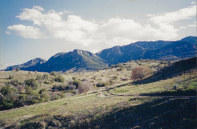
Back in the early 2000's I came across a blog about a camping trip to Deer Creek in the Galiuro Mountains in southeastern Arizona. It looked really nice to me so I got a wild hair and decided that would be our spring break camping trip. It was surely a remote and unlikely spot given we live in Las Cruces, NM, over 200 miles away and with many other similar mountain ranges to explore much closer to home. Still off we went. My memories are little dim, but I do recall thinking on the drive in, that the mesquite trees in this part of Arizona were more like trees that the low growing bushes we have close to home. We found a nice camping spot with a few junipers and oaks just inside the Coronado National Forest boundary, north of Deer Creek and just south of Oak Creek. We were using one of those large tents that attaches to back of pick-up or SUV, in this case a '96 Ford Explorer.
Our big hike for the trip was using the East Divide Trail ( FT 287) to get to Kennedy Peak, which as I remember is the second tallest peak in the range. It was a good hike and we made it to the top, but since we didn't drive closer to the actual trailhead, it was a very a long day. I remember the beautiful shady canyon of Oak Creek flowing with little waterfalls, a long uphill push on the side of an " arm" descending from the Kennedy Peak ridge which was very, very brushy, and then the desert vegetation on the peak itself. The views were fantastic.
Other days we descended to the lower end of Oak Creek on a use trail, and enjoyed the sunshine and the beautiful flowing creek.
NOTE: as stated above this hike was done in the early 2000's, the conditions for the trail reflect what was to be seen at that time. It appears through viewing recent satellite images that forest fires may have significantly altered some of the areas the trail passes through.


No comments:
Post a Comment