Friday, June 14, 2019

Rim Trail ( FT 105 ) Southern Trailhead to West Side Road ( FR 90 ) - Lincoln National Forest


I lost the actual trail early on in this hike, and unbeknownst to the ol' Pathfinder ( yours truly) was walking on the very faint remnants of an old road instead. Writing this blog in my mind as I traversed on this road (aptly called 90 Z) on maps for the middle portion of the out hike, phrases like " uncharacteristically  un-maintained with abundant uncleared downfall, " hard to follow with no blazes,"  and " mercifully almost- level unlike most of the southern stretch of the Rim Trail." Why I wasn't clued in right there I don't know. Adding to my lack of awareness was the fact that the road brought me right  back to the real trail perhaps a half mile from my turnaround point at the West Side Road.

 It was only on the return trip where I stayed on the real trail ( and didn't even notice where the point of convergence was) that I realized what I had done, Oh well, so it ended up being a two stemmed loop hike.
 The real trail had a very clear tread( excepting a couple places where I lost it briefly) and was blazed. Most of the downfall had been sawed and cleared. It was also more typically steeply up and down  as it tried to stay close to the rim and its natural undulations. It was also far more shady which was a mercy to my hot, black Scotties who overworked themselves in the very first steep climb through the shade-less burnt country, that is slowly recovering with a lush, but low still, growth of gambel oak and locust.

 After that they were two panting machines,  so there was a lot  resting where we could find shade and lots of water guzzling as well.  It never go above 70 degrees but the sun at high elevation can make it feel like 90. Frequently getting tangled in the routes through and around the downfall on the trail that wasn't didn't help with our progress or my overall disposition.
 Needless to say the  back leg of the walk consumed about a half hour less time, even with lunch and even more frequent resting included.
 Highlight were the views from the rim ( of course ), but also a nice little hollow with many maple trees down in Bridge Canyon, which I now have plans to revisit come October.

 I have now completed my section hike of the Rim Trail.  I  started  hiking it many years ago, but I really only came up with the notion of seeing the whole thing in the last 4 or 5 years. Doing it this way with out and back hikes  amounts to  doing twice and seeing it from both directions which has  some benefits. One might be better off just doing two or three shuttle hikes. Backpacking would be little hard because there is virtually no water along any of the route unless there is still snow on the ground.

Labels: , , ,

Wednesday, June 12, 2019

Broad Canyon Wilderness and Sierra de las Uvas Exploring - Organ Mountains Desert Peaks National Monument

Rattlesnake Hills


I did these two little hikes over the last  couple of weeks. I got a later start than I wanted with both and the increasing heat had me regretting it. Still I kept it short, around two hours, so there wasn't a lot of  suffering. Not much to report from the one in Uvas. I hiked down a shallow canyon that is one of the uppermost branches of Bignell Arroyo, and then came up sub- tributary to a saddle then down across upper Hersey Arroyo and back to my vehicle. I am always looking for  whatever catches my eye, but there are many areas in the Uvas that just look overgrazed, sere and unappealing this time of year. Of course finding some evidence of ancient peoples, or at least some scenic natural phenomena would help this to improve this estimation, but none were forthcoming. The heat didn't help either.
 The second was more interesting. I hiked down a side canyon which is a tributary to the tributary to Broad Canyon that runs through the Rattlesnake Hills. This area has the only exposures of Permian sedimentary rocks in all of the Uvas, Cedar Hills area, including the famous Abo Formation which is alway good for looking for fossils. I had spied this canyon back when we hiked through the Rattlesnake Hills a couple of winters ago. This is a scenic area, though not as nice as Broad Canyon itself, or some its side canyons further downstream, probably best visited in the winter months.


Labels: , , ,

Tuesday, June 11, 2019

East Fork Jemez River-Santa Fe National Forest


One of the nice things about visiting Albuquerque is that it puts the fishing waters of the Jemez Mountains in range for a day trip. A few years back I took advantage of the proximity for a trip to the Rio Cebolla. On that journey I made a pit stop at Battleship Rock on the way and a fly-fishing couple who was there almost had me almost convinced as we talked in the parking lot to forego the Cebolla and fish the East Fork Jemez. I didn't. I had my adventure and caught a few fish up on the meadows of the Rio Cebolla, but the East Fork was the first destination I had in my mind last Tuesday.
  I don't think I could feel anything less than awe even if I drove up NM 4 into the canyon of the Jemez River everyday. The sight, immediately washes away the petty frustration of wanting to get out and get fishing and having to mind the  posted speed limits on the way.
 I got there about 8:30. Battleship Rock was still cloaked in shadow, while the cliffs high above were brilliant in the morning light.
 No one was around as I  walked down the stairs, crossed the bridge and headed to the stream. I followed the  real trail for short ways but when it went up high,  I then headed off down one of the many fisherman's paths that  line the sides of the creek exposing the red soil wherever they go. It's rough going down on the stream. There's chokecherry, red osier dogwood,  and willows that thickly line the banks and nary a level spot to stand on that's not in the water.  Luckily my boulder hopping skills are still top notch, although who knows for how much longer. I would also be remiss if I didn't mention that's there's poison ivy too, so leave the shorts at home. Above, pines and firs cling in the volcanic cliffs that look as dry as the river is wet.

 The water was a definitely a bit high, with a lot of froth about, tea colored, but not overly murky.
Alan Bray has  written a book Fishing the Jemez Mountains of New Mexico (2nd Edition). He sent me a free copy after I let him use one of my pictures of Cañones Creek. His advice seemed to tend  towards using dry flies, that's all I needed to read, because really I want to use dry flies all of time anyway. I tied on an elk hair caddis. I caught a seven inch brown from the middle of the creek within the first few casts. Then I hooked and landed a really a nice brown of 12 inches or so drifting the fly blind  around a boulder that sat on the edge of river.
 I moved upstream, using the paths, balancing on boulders, and occasionally plunging right in. I caught a couple of more small browns, hooked and lost a couple of others. There was not a lot of calmer water for casting dries, and they only occasionally darted out with that speed  that always astonishes in the riffles and turbulent water below the many little falls.
There were couple of ideal, slower, deep runs close to each other though that I spent a lot of time on. I  hooked, fought and then lost what I'm pretty sure was rainbow (I could see the red band ) that I"m sure would have exceeded the bigger brown I had caught earlier, and had hook-ups with some that were bit smaller. I eventually caught  a 10-11 inch rainbow on my return pass through. It had the dull colors of a stocker, but since the East Fork is not stocked anymore, it must have moved upstream from the main Jemez. The larger rainbow, I feel had to have been a stream bred fish,
 I got to a point where I could no longer move upstream, at least not on the side I was on because of falls, deep pools and cliffs. I backtracked and found the real hiking trail, but when I realized it was only going to take me high above the water, I decided to cross the stream instead.
There I followed paths up and down, with infrequent stops at places that were amenable to casting and had good holding water.  I caught one maybe two more small ( 6-8 inch range) browns.  I could feel the high elevation sun toasting my neck and my casting arm and six relentless hours on the steam was wearing me down especially after the previous day's long hike. I  rested in the shade and ate my egg salad and crackers.Then I turned around and headed downstream. I tried a bead head prince nymph towards the end of my fishing day, just to see if I had been missing out on some fast sub-surface action. I wasn't. I met a kid with a spinning rod and briefly chatted. I heard shouting a few minutes later. Maybe he caught that rainbow.
The clouds moved in and as I drove away the afternoon rain started just as if we were having the monsoon a month early.


Labels: ,

Monday, June 10, 2019

Sandia Mountains Wilderness Loop Hike (Cienega, Crest, Cañoncito, and Faulty trails) - Ciblola National Forest


This was a long loop hike I did on our first full day visiting Albuquerque.  I wasn't totally committed to doing the loop, which is shaped more like a trapezoid, when I first started out. I had  only looked briefly at the trails map online, and the loop option looked a little long, owing to the fact that the returning sides of the hike required  an additional 1.8 miles of hiking.
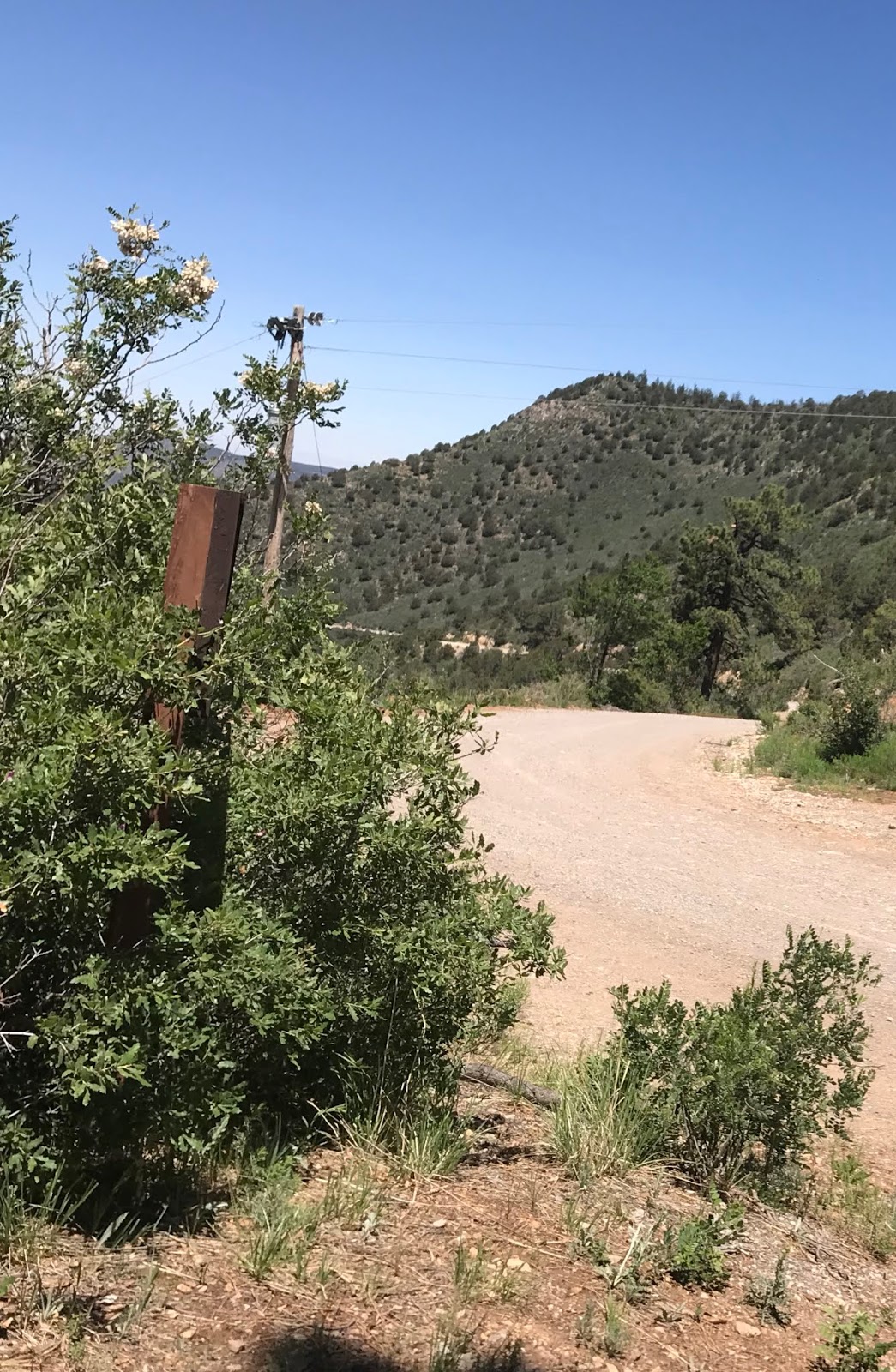
 I first arrived at Sulphur Canyon in the warmth of last Monday's morning sunshine thinking this was my trailhead ( I told you I had only briefly looked at the trail info.). I couldn't find anything to write with to fill out my little fee ( $3.00) stub and was getting really frustrated with the whole process, when I was saved by the tiny pen in my Swiss Army credit card- sized tool kit that I keep in my backpack.
 I then drove up to the trailhead and began hiking on the paved Sulphur Canyon trail for a little ways until I decided it wasn't what I wanted ( little did I know I could have crossed over to the Cienega in a short distance). I returned to my car and then drove over to the Cienega trailhead and started out along the trail where water was flowing beside in  the tiny stream. Both Sulphur Canyon and Cienega picnic  areas were looking lush and green and would be lovely places to enjoy a repast.  There is no camping.
 Trail descriptions of the Cienega Trail ( FT 148) that you may see online or in guides may be a bit outdated.
  I soon discovered that many of the trees ( large cottonwoods, pines and box elders) that once shaded the stream trail have died. Much work appears to have been done in recent years cutting up downed limbs and re-building the trail. Bottom line: this is fairly open terrain now and you will feel hot, as I did, climbing steeply upwards on a sunny day. I saw only one other group on my way up. A dad was smartly slathering sunscreen on his two pre-school daughters, one of which he was carrying on his back.
The trail entered the Sandia Mountains Wilderness shortly after I passed the junction with the Faulty Trail  which I vaguely remembered from a trail description and knew I would use if I decided to a make a loop.I made good time over 2 plus miles to the crest despite 1600 foot elevation gain, the worst of which was definitely in the first  mile. I only occasionally stopped to look at flowers, admire the view behind me, or catch a breather where the shade seemed deep enough under a decent sized fir or pine.


Chokecherry, box elder and gambel oaks grew thickly trailside with their new access to sunshine previously controlled by the now deceased pines and firs. The live water of the stream didn't last long and as I got closer to the crest the landscape became dominated by oaks that were yet to leaf out.

 At the crest, the Pino Trail goes down the other side and there was chewed up post  of a sign that  indicates the intersection.
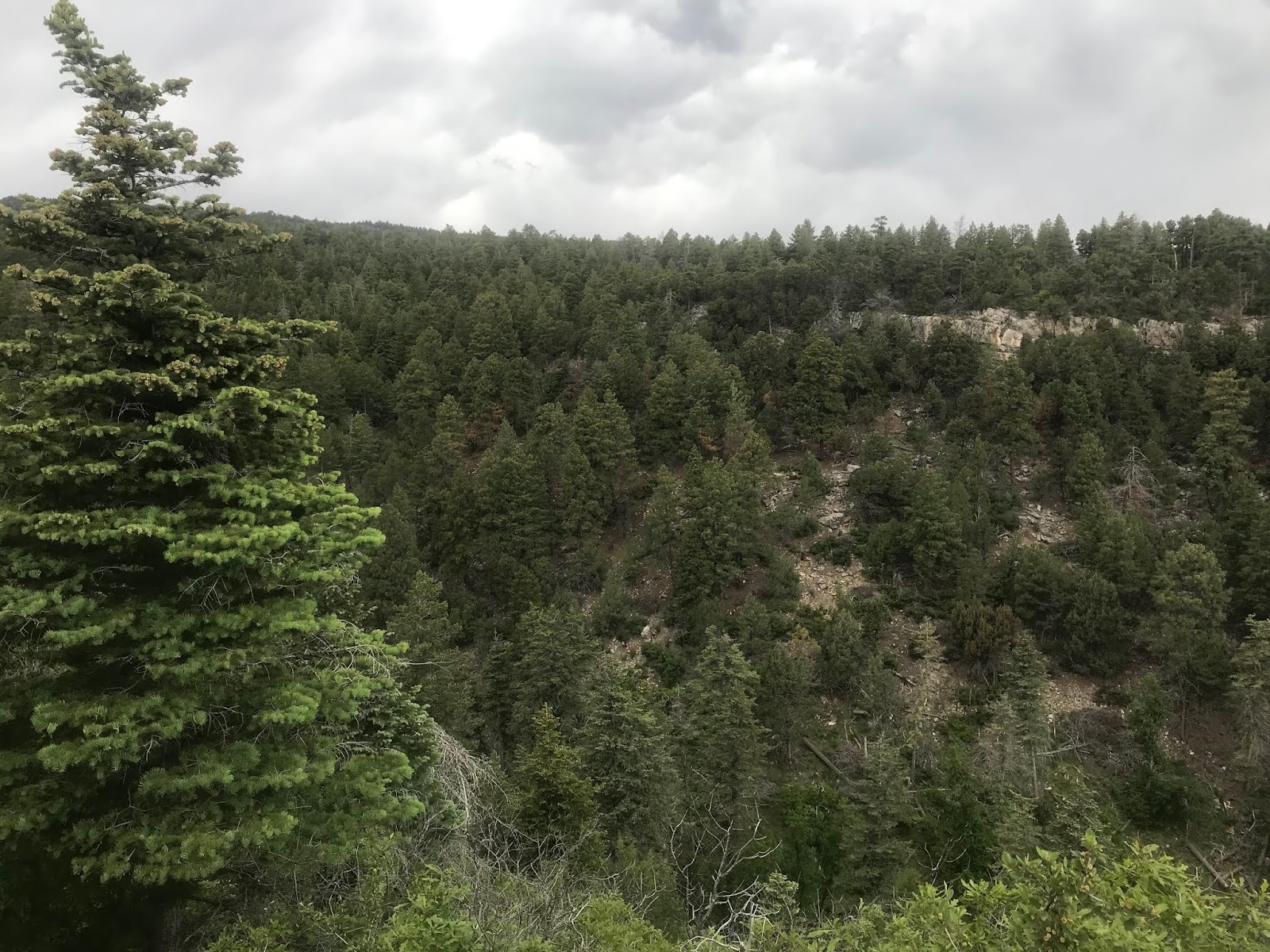
I enjoyed the views out to the city and to the nearby cliffs of gray limestone and then headed south on the  Crest Trail ( FT 130).


I still had thoughts that I that might return the way I came at this point, but when the trail, after an initial ascent, began going down and down and down to the intersection with the Canoñcito Trail (FT 150), I knew I was going for the loop rather than climbing back up. Another factor in this decision may have been that storms were in the forecast( the previous day we had just missed a strong one while driving on the east side of the Manzano Mountains) and the skies were quickly filling in with clouds. The sparsely forested crest is no place to be in a thunderstorm. Unfortunately, for this reason, I hurried through this segment which is definitely the highlight of the hike with mostly only low growing oaks which do not hinder  the spectacular views east, south and west.
 Another post( less chewed) showed me I had arrived at the Cañoncito Trail and I began to rapidly descend. I stopped for lunch where the conifers grew a little more thickly and then I was off again.
 This trail has not been maintained recently and does not appear to see much use either.There were downed trees, a few very rocky sections, and overgrown corridors. Plus, it's steeper and longer than the Cienega Trail as well. It's wasn't hard  to follow for someone like me used to the very rustic trails in the southern half of the state, but I would only recommend it as descending route and it is probably not well suited for those who don't  do a lot of hiking.

 I was thankful that the  intersection with the Faulty Trail ( FT 195) was well signed as a little bit of worry had creeped in given that the Cañoncito Trail seemed to be  a less than the well travelled part of the forest.
The Faulty Trail, by contrast was well built, and well maintained. It lies just outside of the wilderness, which may (or may not)  be a factor in this. Unfortunately, the comfortable dirt tread wound in and out of several drainages and up and over  and down the intervening ridges. At times it order to gain elevation to cross over, the trail would turn in the opposite direction it was heading, which was worrisome until I would realize I was beginning another long lazy switchback. It  was an exhausting last couple of miles. It was warm and humid now as well. I stopped where the Armijo Trail (FT 222) moves off to the east and Faulty Trail crosses Armijo Arroyo which back here in the forest had a decent flow of water. I ate my apple and then moved on.
 I could have shouted for joy when I finally stood on the ridge looking down at the intersection on Cienega Canyon that I had passed by more than four hours ago.This was only my fourth hike in the Sandias. I like these mountains and the nearby Manzanos as well, where I've only hiked once. There just too far for a day trip from Las Cruces, but when I'm visiting our biggest city they fit the bill perfectly. And since I've gone exclusively on weekdays, I've encountered few people which is definitely what I'm used to.
 A group, grandma and grandpa with their two grandsons, were coming down as I arrived. It was an easy walk back to my vehicle. The rain started shortly thereafter.

Labels: ,