Monday, April 30, 2012

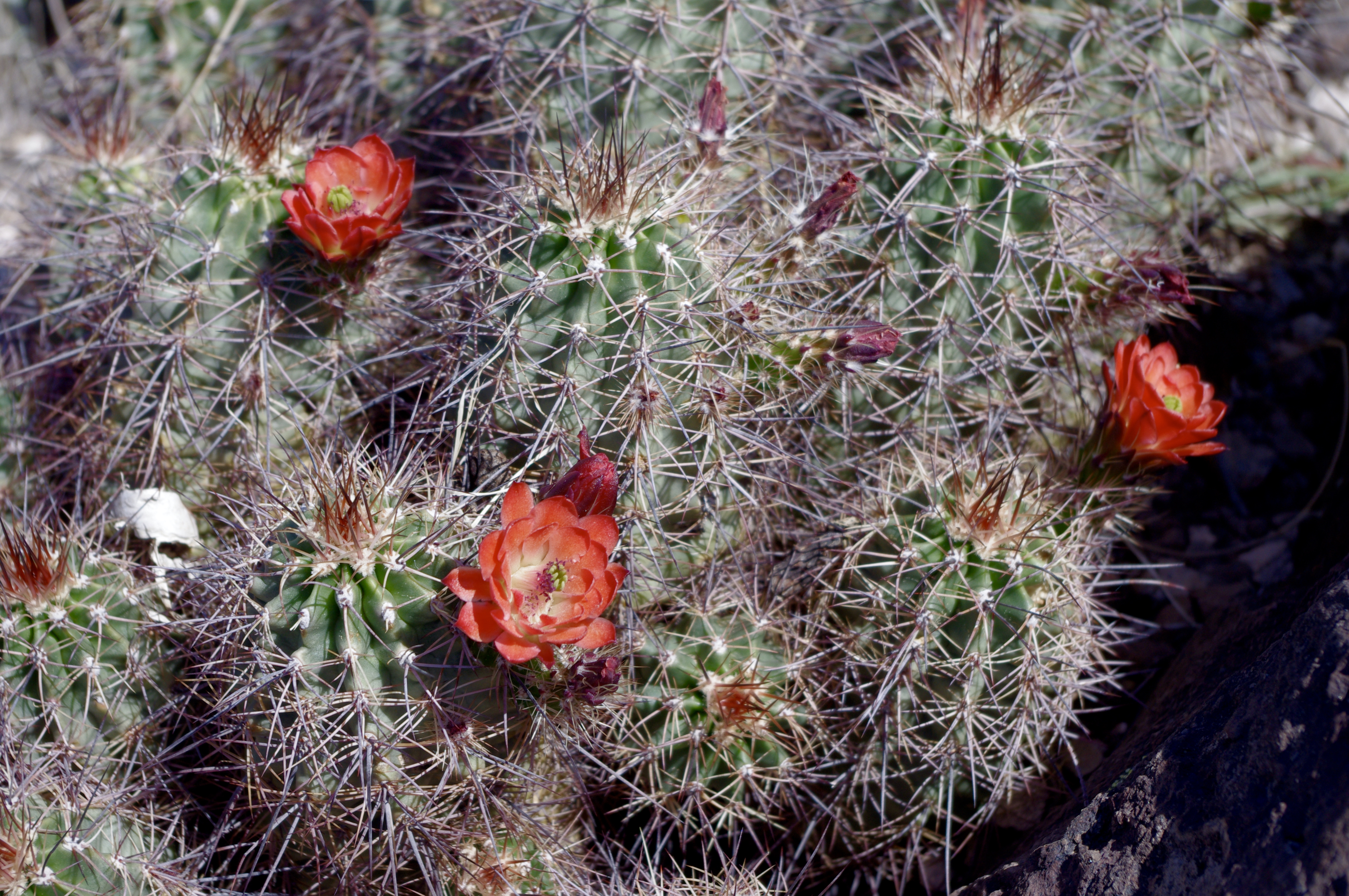
Meadow Creek, Signal Peak- Gila National Forest

Just a few miles up the road(NM 15) from Cherry Creek Campground is the trailhead for the hike to Signal Peak. We did this hike a few years back when we stayed at the Nature Conservancy's Bear Canyon Lodge near Silver City.The trail starts on the east side of the road, but there probably isn't any parking there. We had to park a few hundred feet past on the west side at the Tadpole Ridge Trailhead.The first bit of the trail can be hard to find as it crosses the (usually) wet meadow that is the headwaters of Cherry Creek. From then on the trail was easy to follow. It has some signs of overuse even, where too many people have chosen their own little paths and have widened the tread quite a bit in places. This happens to many popular trails (I'm thinking of the Pine Tree Trail in the Organs as another example), so please stay on the most well-worn route and don't deviate. As I remember, it's pretty steep going in mostly deep forest at first, but eventually we ended up sidehilling on the mountain's south side with views opening towards Silver City and the desert grass lands beyond.  At the top, we were invited by the fire spotter to come up the tower. Here, we could see most of the Gila Wilderness and the western half of the Aldo Leopold Wilderness as well. It was fun pointing out  various peaks and canyons and the lookout appreciated my accuracy.
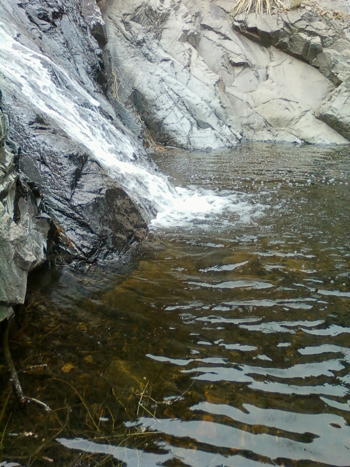
        A few miles beyond Signal Peak Trailhead is the Meadow Creek Road. The top part of this route rolls  along a fairly wide and level mesa with spots available (and used) for dispersed camping. Then it gets very narrow and takes a pretty steep plunge down to Meadow  Creek. This is a very pretty area, grassy and open with large deciduous trees, but getting down here may not be an option for passenger cars or those towing large trailers. Hiking downstream is very nice when there's water flowing in the creek. The second  time I came down here I was looking to see if there were any trout left in these upper reaches. I did see some fish, but they weren't trout. One stretch is a sort of slot canyon with several large "potholes" carved by the tiny stream into the gray volcanic rock. I  either had to wade through the waist to chest deep pools or turn back. Since it was July and in the mid-90's, I didn't mind getting wet. There were even more fish in these deeper holes, but once again, they were not trout. The stream opened up again, but the water went away. It looked like a bouldery road instead of a  creek for the next mile or two and I gave up on the fishing. The water may come back further downstream, which may be where there were a few trout still- I don't know. It was a fun hike anyway- and the swimming holes were a definite plus.Update (May,2014):Parts of these areas may be inaccessible due to the Signal Fire.

Labels: ,

Tuesday, April 24, 2012

Cherry Creek Campground- Gila National Forest

 I'm going to stop writing about desert destinations until the weather cools down again.  Luckily, I have a backlog of forest hikes, camping spots,  and fishing creeks that I want to get on to the blog. When we first visited New Mexico, we camped at Cherry Creek in the Gila National Forest on  NM15  about fifteen miles north of Silver City . We visited the Cliff Dwellings, the Catwalk. and walked around the old mining towns of Pinos Altos and Mogollon. We dined at the Buckhorn ( in Pinos Altos), and I seem to remember a very silly  performance in the style of a 19th century melodrama going on while we ate. One thing that was a bit of surprise for us, coming from humid Houston, TX was the much larger temperature gradient. In Houston once the mercury starts hitting the 90's, overnight lows are typically in the 70's. We were quite cold that first morning( it was June) when it was probably in the low to mid 40's! In the daytime we cooled off sitting in the East Fork of Gila River at Grapevine Campground.  Cherry Creek Campground suited us fine at the time. The nearby gorge of Cherry Creek with its sheer cliffs and spires of volcanic tuff was quite impressive to us newcomers to southwestern landscapes. Coming from Texas, where there is very little public land and most camping is done at private campgrounds or state parks, we had no concept of dispersed camping. Nowadays, I would hesitate to recommend place like Cherry Creek CG or nearby McMillan CG. They're too close to the road and to town and too,too small.

Labels:

Tuesday, April 17, 2012

Sierra de las Uvas-Sierro Kemado


Tonuco Mountain


Sierro Kemado Peak

View toward Mesa Azur


View toward Sierra Alta Peak ( left of center)


 From where I parked at a water trough just off the Barksdale Road( County Road E OO6), Sierro Kemado (don't blame me for the spelling that's how it's written on the topo map) looks to be an unassuming gently rising rounded ridge, unlike many of the other peaks in the range which are very steep sided terminating abruptly with flat tops or with true points. Looks can be deceiving. When  Seamus (my Scottie dog) and I reached the top we could see it was a hill cut in half. Rocky cliffs drop sheerly away for the first  hundred feet or more followed by very steep angled talus slope for the next few hundred feet which ends in the broad table top north bank of  Broad Canyon; the largest arroyo on the east side of these mountains. The views all around were fantastic even though we'd only come up  600 feet. The Uvas are easy to take for granted but are really quite beautiful, and maybe even a bit majestic- especially the higher elevation central core of the range:  pointed peaks and long mesas piled up on one another culminating in the serene Mesa Azur. We did a  three mile loop going up one ridge and coming down another.The mountains are greening up a little this spring. Mexican poppies and other wildflowers were blooming. A few cactus were showing their bright red blossoms as well. 
The  going was pretty rocky and I wished I'd worn my real boots. Seamus did alright until he walked through a patch of some kind of weed or wild flower that left him covered in tiny sticky seeds.  I saw the largest horned lizard I'd ever seen, but no snakes. It was very nice to sneak in one more desert hike on this cooler day. Sorry, I didn't get any photos of the cliff side of the mountain.
Top of Sierro Kemado


Labels: ,

Monday, April 16, 2012

Doña Ana Mountains- natural arch


One April, a few years back, I did a short hike to this small arch. It can be seen( just barely) from I- 25. It's definitely not off the beaten path if you are any kind of OHV-ORV enthusiast. In fact the day I hiked up , there were several jeeps on their way to the same place.  When I arrived, a couple of guys on dirt bikes had just gotten there as well ( see photo). There are many unofficial roads and trails in this section of the Doña Anas. Some of them, like the road from the west approaching this small arch, are so steep I don't see how they keep their vehicles from flipping over backwards. The roads are also a little confusing, unless you're out there driving around on some GPS guided route. I found myself going cross country some of time just keep on a line to my destination. I ended up making a loop by hiking along the ridge the arch sits on to the south and then picking up another road that brought me back to my truck. This part of the Doña Ana Mountains has lots of scenic rock formations that can make for great photos. I felt a little weird hiking when everyone else was in or on some kind of vehicle, but this is a fun little walk.

Labels:

Saturday, April 14, 2012

Doña Ana Mountains- camping


The Dona Anas used to be one of favorite stomping grounds for hiking and exploring. Along with the nearby Robledos, they are the closest mountains to my house.The Dona Anas are not a typical fault block range like most of the mountains in this area. Lacking a distinct ridge line, they appear as a cluster of large and small, but usually very steep peaks, and are the uplifted and eroded remnants of a volcanic caldera. There are many little joys to be had while hiking in the Doña Ana Mountains: winding arroyos, small natural arches, a few old mines and prospects, petroglyphs and grinding holes, and, once you get off the beaten path, a sense of peace and perspective so close to the city. Once we even camped out there. This was back in 2003 on the night in February when the space shuttle Columbia disintegrated coming back down to earth. We set up  on  a little natural platform tucked back among some peaks on the northeast side of the range's high point (and one of only two named peaks here) Doña Ana Peak. There was some graffiti marring some of the large boulders, which was a little worrisome,but we spent a peaceful, cold night underneath the Milky Way. The next morning we went for an improvised hike up over some low saddles, down and up an arroyo, making a small loop back to our camp. Along the way I took pictures of a perfect little beauty of a natural arch, and my wife took a picture of me next to a very large barrel cactus. We both were dismayed as we gazed back at Las Cruces at the thick haze created by the annual burning of trimmings in the pecan orchards( this continues still, there's got to be better way). I'm glad we made this little trip when we did. Las Cruces is too big now( it's beginning to  surround the range on three sides) . I wouldn't feel comfortable camping so close to the city now . The reason large parts of these mountains are either off limits or with limited access now is because of vandalism and irresponsible behavior. Note: the route we used to get to the area where we camped is now only open during times when the Chihuahuan Desert Nature Park is open. There are other ways to get there from the west and south,but the roads may not be suitable for many vehicles and will require high clearance, 4wheel drive.

Labels: , ,

Sunday, April 8, 2012

Mineral Creek, 2012-Gila National Forest


There are a few differences at Mineral Creek in the Black Range this year. For one thing, it has water, which is nice. Last year, there was only the tiniest of trickles when we visited in the spring. Since there was this good fortune, I decided to "find" the hidden waterfall that I've suspected was there for several years now. I found the bushwacking along the stream much easier this time since the creek side vegetation is still mostly bare . A few years ago I tried in September, and gave up, wishing I had machete( just kidding). The falls are awesome , close to 40 feet high I would guess, and I can only imagine how spectacular they would be in a year with a lot of snow or after a summer with really good rains. There may be some smaller ones directly above as well, but that will have to wait for another trip. There was a more foreboding difference as well on this trip. Along the creek they are several posts with pink ribbon and plastic film canisters attached. Inside the canisters are notices for mining claims for lode mines by the Genesis Gold Corporation from Salt Lake City,Utah. This area was never known for gold production( that would be the mines east of Hillsboro about fifteen miles away). It was almost exclusively silver mining, and after the crash of silver prices in the 1890's, has been all but forgotten by the mining world. It may be that any amount gold would pay, when prices are so high. This would be an absolute environmental disaster for this area. There just isn't enough water here to mine on a large scale. In addition, these claims are only about a mile from the Aldo Leopold Wilderness boundary. Mining along this riparian area would certainly impact the recreation values of the wilderness, as well as seriously disrupt wildlife who need this precious water source. It may amount to nothing. Or, it may be the beginning of a nightmare, and a long battle similar to what is going on right now with the Copper Flat Mine near Hillsboro.IMPORTANT UPDATE: This hike is within the Silver Fire burn area.

Labels: ,

Tuesday, April 3, 2012

Franklin Mountains State Park


I've hiked here several times. I've done the short,but steep, hikes to Aztec Cave and West Cottonwood Spring. I've also done a longer hike to South Franklin Peak a few years back . It was a windy autumn day and both my stepson and I got intense static shocks from the metal railings at the top. While we were hiking, someone smashed the passenger side window of our car to take a cell phone I'd foolishly left in plain view. Alex ( my stepson) had to ride in the backseat with his head down as I used mostly the frontage roads to get back to Las Cruces. Never forget that this is a state park within the city limits of a very large city,which is part of even larger metro area. My best hike here was up over the ridge line and down to the tin mines site on the east side. One thing I like about hiking here is that there isn't cow crap everywhere. This is a pleasant contrast to the many BLM and Forest Services lands I frequent in New Mexico. I know I've only scratched the surface of the places to explore here and I'm still planning on doing a hike to North Franklin Mountain( the range's highpoint),but for reasons I can't quite put my finger on,I almost never think of this area as a first or even second choice for desert hiking. We used to, almost as a custom, take Trans Mountain Road back from the airport either to give guests an introduction to the beauty of desert mountains,or just to enjoy to the outstanding vistas ourselves.

Labels:

Monday, April 2, 2012

Franklin Mountains-Webb Gap( Sierra Vista Trail)


The first time I hiked here I was planning on climbing North Anthony's Nose using the directions in Greg Magee's Dayhikes and Nature Walks in the Las Cruces- El Paso Area. Now as much as I apprecitate Greg and his guide's opening up a whole world of desert hiking for myself and many others, this is another instance where I strongly disagree with route choice. The dry waterfall that must be scaled or negotiated around at the back of the canyon immediately to southeast of the peak is no piece of cake. My wife and I gave it our best shot , getting scratched and poked numerous times in the process(it is replete with sharp desert vegetation) before giving up,concluding that while a fall here may not be fatal,it would probably cause substantial injury. And while the risk of such a fall may have been low, it wasn't low enough. If you're a diehard scrambler,by all means have at it.We, however, left,peak unsummited . Later, I scoped out an alternate ridgeline route,that I'll keep in mind for a sunny winter day. The second time out here, we parked at the trailhead at Anthony Gap and did a long hike north along the old road on the east side( which is now part of the Sierra Vista Trail).Eventually we headed west up to Webb Gap, a low pass in this section of the Franklin Mountains. On the west side of the gap is an old jarosite mine. Jarosite is an iron silicate mineral . It has a yellowish brown color and slick looking surface. It is frequently fluorescent I believe.I collected a few specimens lying around the mine shaft,which plummeted in blackness to unknown( to me) depths. Jarosite's main use is as a paint pigment.

Labels: ,

Sunday, April 1, 2012

Broad Canyon Photos - Organ Mountains Desert Peaks National Monument


A few more shots of lower Broad Canyon.

Labels: ,

Broad Canyon- Organ Mountains Desert Peaks National Monument


This is a beautiful hike from fall to spring.  A  mile long section of Broad Canyon about a 1/2 mile downstream from the confluence with Valles Canyon downstream is private ranch inholdings, and the very beginning of this hike is on private property as well( although the remainder is BLM),so please be respectful.To get to the start of this hike,take the Barksdale Rd.( just past the NM 85 Border Patrol Checkpoint if headed north) to where it meets a cross roads up on the mesa turn left, and in a short ways take another left. Follow this road which eventually goes steeply down into and crosses Broad Canyon, where there is parking next to the corral. For more precise directions with mileages and county road names consult Greg Magee's Dayhikes and Nature Walks in the Las Cruces- El Paso Area. Broad Canyon almost immediately boxes up and begins sinuously coursing downstream. In places,the canyon walls are over 100 feet high. There are many interesting rock formations,including some mini- arches.There are a few ash trees and occasional lingering pools of water,so there is a chance for spotting wildlife . At one point there are petroglyphs to be seen on the smooth rock at the base of a cliff. Right before the canyon opens up to become a wide, sandy, less than interesting desert arroyo, there is an almost slot canyon section where it stays dark much of the day. My wife and I have hiked here twice and enjoyed it immensely.Note: this section of Broad Canyon has several dry waterfalls, and is a well known route for rock crawling off road vehicles, so have a back up hike in mind,just in case they are in there.

Labels: , ,