 |
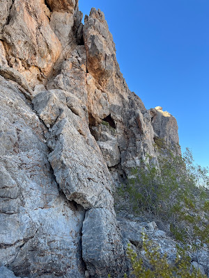
| There is an archway opening in the cliff here |
 |
| Eagle Nest |
 |
| Eagle Nest |
 |
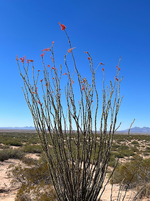
| Late blooming ocotillo |
 |
| Eagle Nest |
I visited the Butte Peaks and Eagle Nest in the far southeastern part of Luna County a couple of weeks ago. I've been wanting to visit these little mountains that rise very steeply from the desert plains and playas for awhile now, but until recently I had not really scoped out the best way to get out there. Well, I've got it figured out now and despite the fact that I ended going all the way to Columbus, NM and then backtracking, the roads I used still ended up a time (and anxiety) saver. Only had time for two short hikes, so there's not really much to report. At Butte Peaks there were some prospects, on the east side of the mountain, but since there were no shafts, tunnels or tailings, I believe they may have been for building stone.
 |
| Butte Peaks |
In the sand dunes just to the south of Eagle Nest I found a few sherds of brown pottery, and lithic debris of a very dense yellow shale. On the peak just to the east there was a substantial stone tower that could be seen at a distance. My subsequent research leads me to believe it is not border marker from before the Gadsden Strip was purchased. I don't know what it is for, but hope to investigate further on another trip. Hiking back to the 4Runner I noticed tilted sedimentary beds peaking out from the sand and gravel. More research revealed that this area has some complex geology involving thrust faults, overturned beds and older beds lying on top of younger ones.
It was warm for the last week of October. Recent rains had a few ocotillo blooming. Lizards scurried but no snakes were seen. I was glad in the late afternoon to be hiking in the shadow cast by the massive east facing cliff of limestone at Eagle Nest.
NOTE: After driving through the old POL Ranch and leaving the maintained county road that dead ends there, the roads out here range from the almost okay to the truly miserable. Also, it's best to have a navigator with you and some kind of GPS app like Gaia or On-X, because there will be route finding for sure. Don't count on following tire tracks because this area is so seldom visited in many places there aren't any.


No comments:
Post a Comment