 |
| Juniper on its last legs |
Six years ago, I made a plan to hike all the major arroyos that cut through the southern end of the Caballo Mountains. We started with Green Canyon, which is the largest and most scenic, and then a couple of years later we hiked Garfield Canyon. Last year, we went to Mcleod Draw/Arroyo and just this past Sunday (1/16/2022) I went out to Broadhurst Arroyo which lies in between Mcleod and Garfield.
Broadhurst is probably the smallest of all, but it does have a nice little box that was the focus of my hike. I decided to come at it cross-country by starting off from a primitive road about a one mile west of Mcleod Tank and then heading southwest toward Mountain Tank. The jumbled-up topography, and geology visible after first leaving the truck had me a bit disoriented. After a quick descent from the hill I was parked on, I kept my bearing as best I could, traveling across large upper branches of Green Canyon. Climbing a ridge, I spied a half-dozen deer, including at least one buck, crossing the hilltop in front of me. On the other side I descended a rocky ravine, narrow enough to have a few scrub live oak growing in it. Coming out of it I got back on my bearing with the help of my On-X which was mostly working. Soon I was descending a second rocky defile that directly fed into Mountain Tank.
The livestock pond was dry, of course, with gnarly old salt cedars on its edge that look more than a little forlorn in this gray, dry and over-grazed little corner of Chihuahuan Desert.
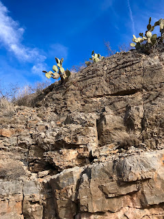
I made my way around and soon entered the box canyon of Broadhurst Arroyo. Along the way, there were manganese and calcite veins, chert nodules, and many indistinct fossils in the limestone bedrock of the stream bottom. The layered cliffs of sedimentary rock above that seem to tilt to the southwest were cut crosswise and lengthwise by the zig-zagging canyon. I could see vehicle tracks ever since leaving Mountain Tank, but let me tell you there is no road in Broadhurst Arroyo, at least not in the box section.
There are old mining roads all around it, but whatever was making these tracks had to be one of those super high clearance rock crawling things as there is a natural dike of rock that crosses the canyon about a half mile downstream from Mountain Tank, never mind the boulders, and extremely tilted sheets of bedrock and the fact that the box is barely wide enough for any kind of vehicle at all.
To the west the sun was filtered by clouds and it never really got above the mid 50's in temperature. Still I was glad I left my jacket in the car and got along fine with a tee-shirt with a long sleeve shirt over it. The clouds kept the gray and brown winter landscape looking even grayer and browner, so with little contrast and only fleeting blue skies, it wasn't the best day for photography. I didn't make it quite as far downstream as I wanted. Leaving the last bit of rockiness a mystery as I decided to investigate an alcove, which turned out to be a mining prospect, at the top of the cliffs.
I had been hoping for some petroglyphs, like those we found in Mcleod Draw last year, but really there was no evidence of ancient people forthcoming through the entire hike. Later, as usual, I lamented not continuing a bit farther, and also not returning via a different route to cover more ground. As it was, time was limited, and I could already feel a bit of the cold as the sun slid down quickly in the west. I did stop on a hilltop to eat, drink and rest though. Admiring the views to the high ridge of the Caballos and even to the distant Florida Mountains was a side perk.
My energy so was depleted by my pace (close to top speed for me using two hiking poles) and the rough terrain, that I was feeling a little lightheaded, which is not good when negotiating steep arroyo banks and the slippery gravel of the hillsides. Round trip, this hike was close to six miles. Other than a few scratches from the thorns that penetrated my lightweight hiking pants, I was no worse for wear.


This hike sounds great. We haven't done anything in the Caballos and my hiking friend's last name is "Broadhurst," so I'm sure he
ReplyDeletewould have a vested interest. I've been checking it out on the topo. I found the two tanks you mentioned. Could you give us directions to the starting point. Thanks. Still working on those 10 hikes for March.
From Upham exit (32?) off of I 25 head north on County Road E0 72 ( Spaceport Road). At around 6.6 miles turn left onto County Road EO 94 heading west. This turns into County road EO 75 at some point. Just stay on this well maintained road as curves around the Mcleod Hills and heads northwest. From the turn off it's 11.3 or so miles to Mcleod Tank. After that you can continue north on a primitive road that ascends a small ridge. There is almost nowhere to park once up there, so if you have the time and legs you may just want start sooner rather than drive the very slow 1.3 miles to where I parked.
ReplyDelete