|
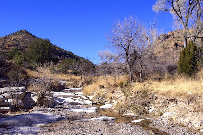
| Fall color on Stoner Creek |
 |
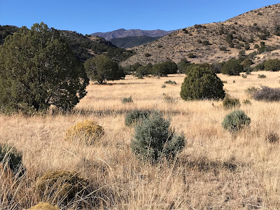
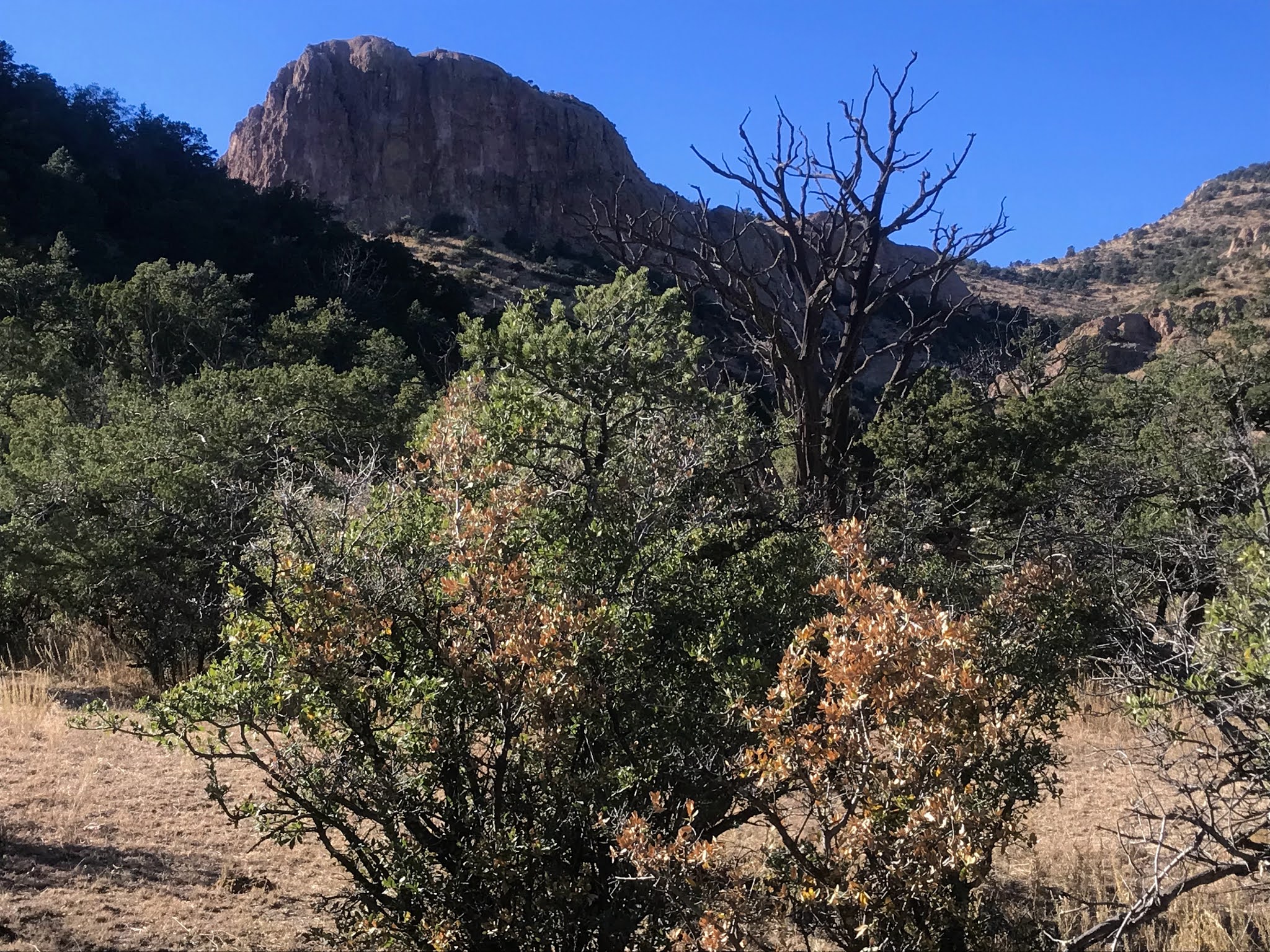
| Pine Spring Mountain towers |
 |
| . |
 |
| Old trailer abandoned along the creek |
It's been awhile since I've been out to southeast side of the Black Range. Back in the early 2000s, I made three trips to Tierra Blanca Creek and one over in Trujillo Creek. I had been thinking about doing a hike in the section of Macho Canyon that is on Gila National Forest land, but it appears that private lands block vehicle access to the Forest Service boundary. I have vague memory of this not being so back twenty years ago. If any of you out there know the situation, please let me know, as I would still like to visit this canyon one day.
Well, I began looking around for nearby options, and became intrigued while looking at Google Earth by the bare rock towers and formations on the southern end of Pine Spring Mountain. I had a destination. Then I saw that it was a short hike over an easy pass to reach Stoner Creek when parking along Tierra Blanca Creek. I had a trailhead. Off I went on Veteran's Day ( Thursday, 11/11/21). I love getting out on weekdays when I can, especially during hunting season, to be assured of solitude, although most of the places I go it's pretty much assured anyway.
Everything was going well. I was making good time on the lonely backroads NM 26, and 27 and then was cruising along at a good clip on the well maintained county miles of the Tierra Blanca Road ( FR 522), when I pulled up behind trailer going around 8 miles per hour. They didn't notice me, which would have been nice, to let me around. It was pretty tight on the road, as it was, but we could've figured something out. I began to worry they were actually going to try and pull that thing onto the really rough part of FR 522 where it veers off to the north for a few miles before returning to Tierra Blanca Creek. If that was the case, their speed was probably going to slow to about 1. I knew I was in for something stupid, but it turned out be more of a knuckler than I expected. At the one closed gate, a passenger from their vehicle gets out to open it. They pull through. Then the guy motions for me to pull through also. I'm reluctant, but I do it. I'd just as soon close my own gate and give these people a chance to find a place to pull over so I can pass. Anyway, the driver hasn't pulled very far past, so I have to pull up very close in order for the passenger guy to close the gate. As the guy is closing it, just barely clearing the back of my truck, for some unknown reason the driver starts to BACK UP!!! I'm honking my horn like crazy. I don't want to throw truck in reverse, because I'm not even sure the passenger guy has closed the gate yet and could be right behind me. It's all happening so fast, but so slow at the same time and then comes sickening inevitable contact of his spare tire hitting the front of my truck. I'm still honking my horn like mad, but it seems to take way too long for him to realize what he's done and stop. He gets out of the truck and comes around as I get out to inspect any damage and says something about me being "so close "and how he " can't see" me. Which begs the question that I didn't ask, IF YOU CAN'T SEE WHAT'S BEHIND YOU WHY THE FUCK WERE YOU BACKING UP? Instead I just told him I had to pull up close so his friend could close the gate. After which a stupid sheepish look came over his face. We looked at the front of my truck together and really didn't see any damage other than a broken clip or two on the plastic bumper cover. I tell him it's all good ( although later I find a few plastic pieces that are slightly off kilter) and we start to move on again. I'm hoping they will have the decency to let me pass at the first opportunity, when, after passing the well traveled entrance to a dispersed camping area, they turn abruptly, bouncing and then breaking a fresh path through the embankment. The trailer followed the truck and I watched, horrified, as it tilted entirely onto one set of wheels. Then, it tilted even farther over to one side so much so that it seemed destined to be lying on its side in the middle of road. I thought " grrreat, first this guys hit me, and now they're going to block the road by flipping over their trailer." By some miracle, it righted itself, and although I would've liked to have had a look inside just to see how badly things had been re-arranged, I just had to trust that it was a little bit of instant karma.
 |
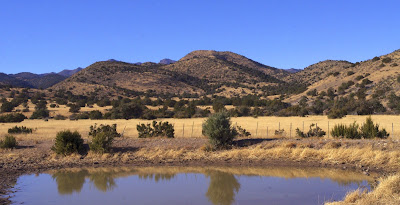
| Tierra Blanca Mountain |
Soon after I was on the private property bypass section of FR 522. It wasn't any better that 20 years ago, but it was any worse either. After FR 522 veers off to the north, I drove a short ways on FR 4146, parked once, thought better of it, drove just little bit more, and then parked at the second to last little camping spot right above Tierra Blanca Creek. The road only went a little farther, and it was definitely not worth it to drive any farther.
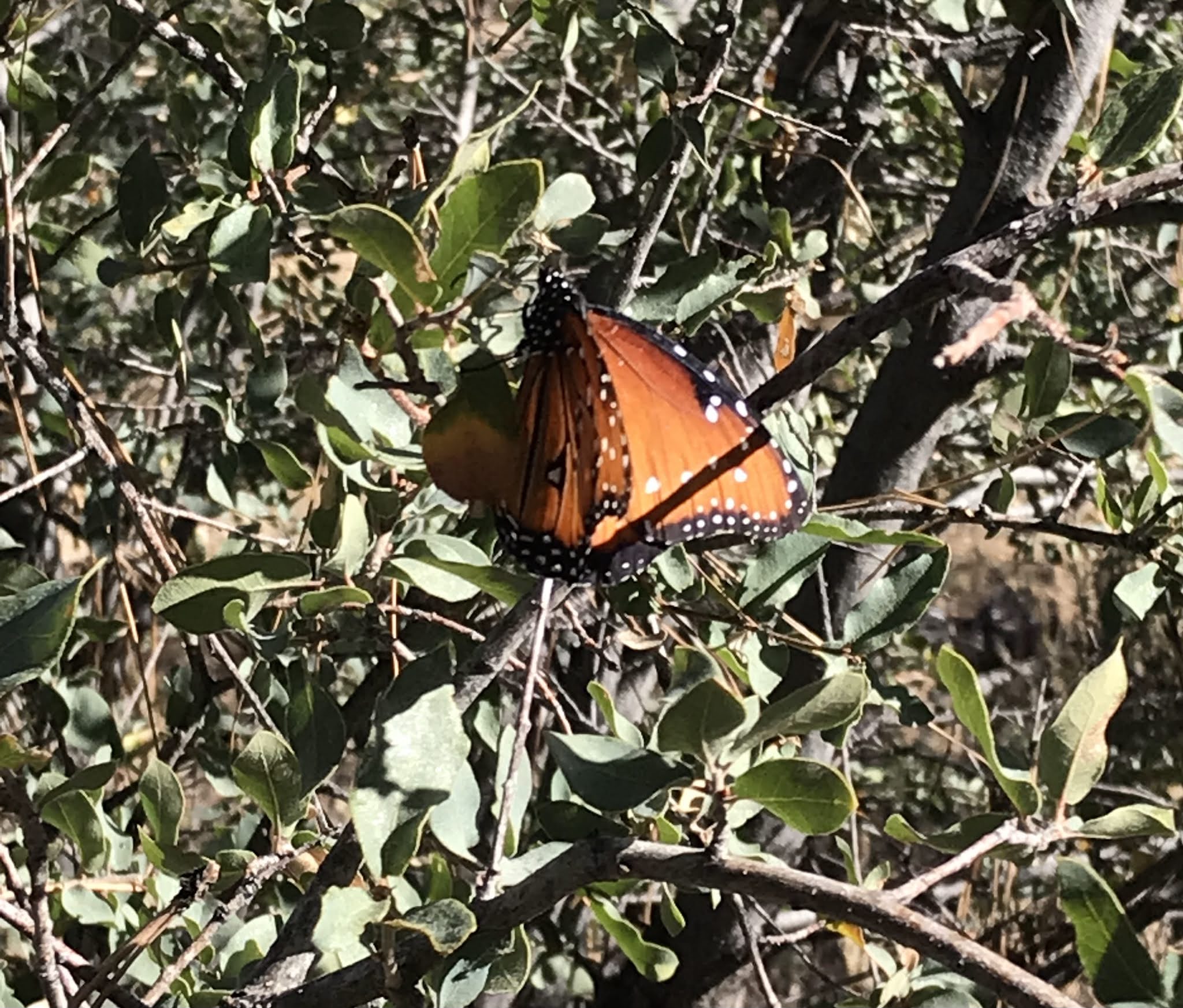
Tierra Blanca had a nice a little flow and a few trees in their fall color where I crossed. On the other side I immediately encountered the aerial ballet of 30 or so butterflies as they lifted off from their perches on the leaves of a scrub oak. An amazing sight and I thought it was surely a good omen for the rest of my trip. Four steps later I stumbled and had a painful fall. . .
 |
| Tierra Blanca Creek |


Upward I went through piñons, junipers and mountain mahogany. The rock formations at the top of Tierra Blanca Mountains glowed on my left, The cliffs on the east side of the ridge extending south from Juniper Peak stood stately and tall on my right.


Quickly, I was at the saddle and then descending on a good cow trail in the dust and sand. At the bottom was a wide clearing along Stoner Creek that was a bit sad to behold. In fact the entire little box canyon that I subsequently passed through has been used for far too long without a rest. It was a little a bit astonishing there was any water in the creek at all given how dry it's been for the last couple of months, but there was hardly any growth of willows, or new alders, or even grasses along the banks. A very lightly used ( and then only by ORVs) road wove through the bottom, and a few cattle shook their dusty behinds and moseyed on at my approach. I couldn't shake the thought that this stream could and should be running ( at the very least in this little box) year round or nearly year round if the allotment could be designated for resting. Narrow leaf cottonwoods, ash and a few oaks provided a bit fall color to ease my distress.


 |
| Stoner Creek |
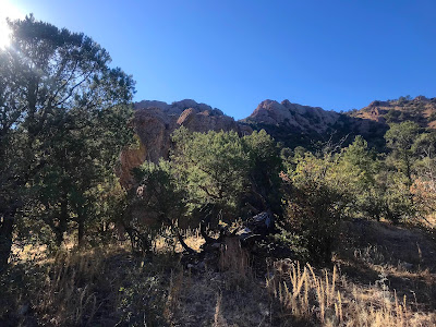
After the box was the confluence of the west and north branches. The latter had some flow, while the former had a wide and dry bedrock channel. It was also lacked any shade so was just a tad warm as well. A young deer clued me in to where my turn would be as I arrived at the ravine channel that comes down from the saddle south of Pine Spring Mountain. Up I went.There was an easy livestock/wildlife trail to follow and soon I arrived at the muddy spring. Wet though it was, there was there was very little vegetation of any kind surrounding it. It's a popular spot with the hoofed crowd.
 |
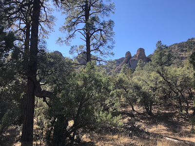
Near the confluence of the two branches.
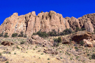
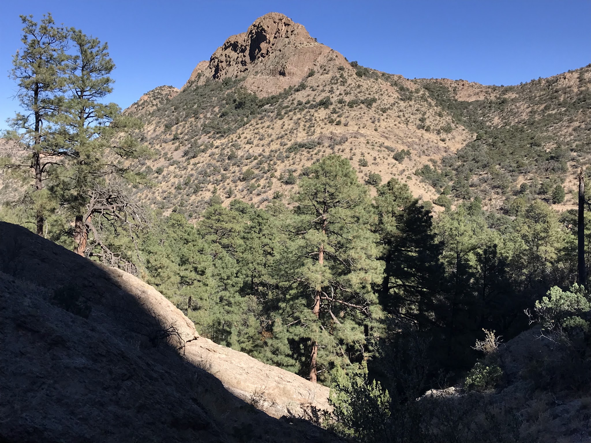
Rock towers of Pine Spring Mountain are
in the center distance. |
 |
| Old trough at Pine Spring |
 |
| Pine Spring |
 |
| Pine Spring Mountain highpoint |
Up and up I went still. The massive bare rock towers came into view only briefly. Even as I arrived at their base, happening upon two large deposits bear scat, they were impossible to photograph through the conifer forest. A high two tiered dry waterfall was directly in front of me, so I began hiking steeply up the left side, slipping on pine needles as I went. I made it up quickly, and now was on the bedrock basin below the peaks with nothing to obscure my views and photographs. I carefully crossed over to the other side, snapping photos as I went, of distant views, and the mountain directly across ( to the east ). I worked my steeply down the other side at times on six points, but eventually the grade let me stand and retrace my steps through the forest.


When I arrived back at the confluence, I headed upstream in the north branch, following the narrow road for a bit before sitting down near the creek and eating my lunch in the shade of the tall alders as they shed leaves in the afternoon breeze. This would be nice alternate hike to complete another day- walking up the the rest of Stoner Creek in the shade of its many deciduous trees, as it was I only explored a bit further before heading back.
At my truck, I ate my orange, and listened to Tierra Blanca Creek. The afternoon sun lit up the gold and orange in the leaves of trees up and down stream from where I stood.


Labels: camping, fall colors, hiking, scenic driving