Two of the upper branches of Lobo Draw have narrow, cliff bound sections, with just a small ridge separating them. I've been looking at them for awhile as a relatively low key outing to the Floridas. I had planned on visiting sometime when we were camping at Rockhound State Park, but after getting shut out ( by a locked gate ) on a trip I was planning to Goodsight Well, I decided I was almost to the Floridas anyway, so off I went.
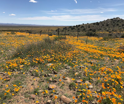
The roads getting there are rough and a bit slow, but very manageable in dry weather. Their shortcomings hardly noticed on this day's adventure because of amazing bloom of poppies and other wildflowers in the rocky slopes all along the way.

It's advisable to drive past the windmill on the road along Lobo Draw, before parking because much of the land east and downstream is indicated as private property on land ownership maps, even though none of it is posted.

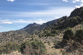
I crossed the arroyo, a rough, boulder laden ditch in its upper reaches, and quickly found the path of one of the two abandoned roads heading up on either side of the north canyon. It was nice to have orange-gold poppies poking through tiny yellow wildflowers to keep my spirits up along the way, because even though I was on good hiking trail using the old road, it's a bit of a trudge up to the ill-fated Atir Mine buildings, especially in warmer weather, with the route gaining about 700 feet in elevation in less than a mile.


Reaching the mine, there are ruins of several buildings, and I could see parts of the ore tram system anchored in the rock going up the hillside high above to the actual mine.


I set out quickly to explore the box canyon immediately adjacent. It's very rough going, as is almost always the case with hidden canyons like these. If I wasn't being impeded by boulders and waterfalls, then the grapevine and other thick vegetation was blocking my way. There was a tiny bit of water flowing with some pools below a pea-shooter 12 foot waterfall. Just above, it was being fed by trickle from a 100 foot ( or more) falls that came from a side canyon and wet the bare rock in its descent.


It seemed like most of the water was coming from here, but I ascended a narrow wildlife path along the opposite wall in the main canyon to investigate further. Topping out I looked down and could tell very little, as the stream bottom was concealed by boulders and live oaks. The main canyon, cut through what appears to be a contact zone between granitic, volcanic and sedimentary rocks also takes a turn, so the upper reaches which Google Earth shows as having a couple of very high, but usually dry, waterfalls could not be seen. It looked very thick below me and the going would be very slow. If I had only planned to visit this canyon, I might have continued( although I don't think I would have gotten far), as it was I turned around.
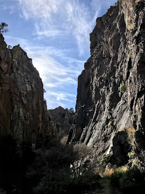
Heading back down I saw the remnant of the road that went up to the mine, and when the dividing ridge was low enough I crossed over to the second ( south ) canyon. There was an old road here to help as well, but it was still a climb. The second canyon, perhaps because it lacks water most of time was much easier to enter. Evergreen oaks, barely budding hackberries and other small, bare, deciduous trees and shrubs guided the way between the towering gray cliffs. There was even a path on soft soil and the plentiful ground greenery we call "weeds." Alas, it came to an end too soon. The way was blocked by an enormous sharp sided boulder choking the passage.


On closer inspection there appeared to be a passage underneath it, used by animals much smaller than myself.
I drank my water, and enjoyed the complete shade before heading back out into the wind and sun for my uneventful trip back down.
I drank my water, and enjoyed the complete shade before heading back out into the wind and sun for my uneventful trip back down.


Thiis was a lovely blog post
ReplyDelete