Saturday, December 26, 2015

Selden Hills


 On three consecutive days( Wednesday- Friday), I did  hikes exploring the Selden Hills, a sliver of low desert hills bounded on the east by I-25, on the west by the Rio Grande, in between Radium Springs and the Tonuco Uplift( San Diego Mountain). After accidentally, discovering some rock art in a nameless arroyo just to north of Buckle Bar Canyon last year( see Flying V Canyon blog in the archives), I started  looking on Google Earth for places that held some potential for finding more.
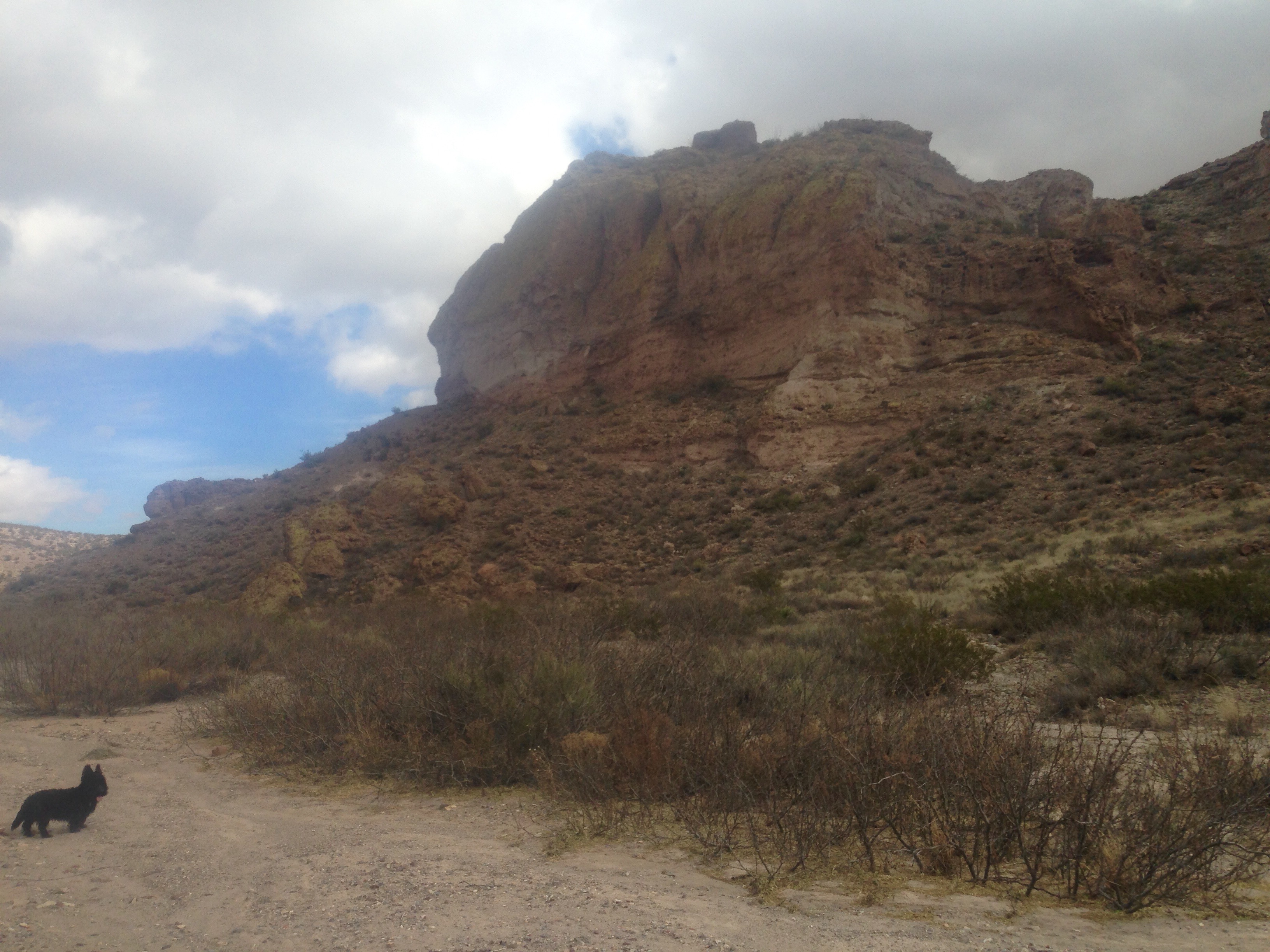
  On our first hike we crossed the river at the mouth of Buckle Bar Canyon, and then stayed to the right in one of its larger tributaries. Near the terminus of this sandy wash, there was a convenient road that took us up and over the ridge and down into a larger canyon to the south. Here, we explored a couple of  very small box canyons carved in, and zig-zagging through layers of dense volcanic rock. Climbing back  top of the hill, we had a wonderful 360 degree view of all the mountain ranges that surround Las Cruces.


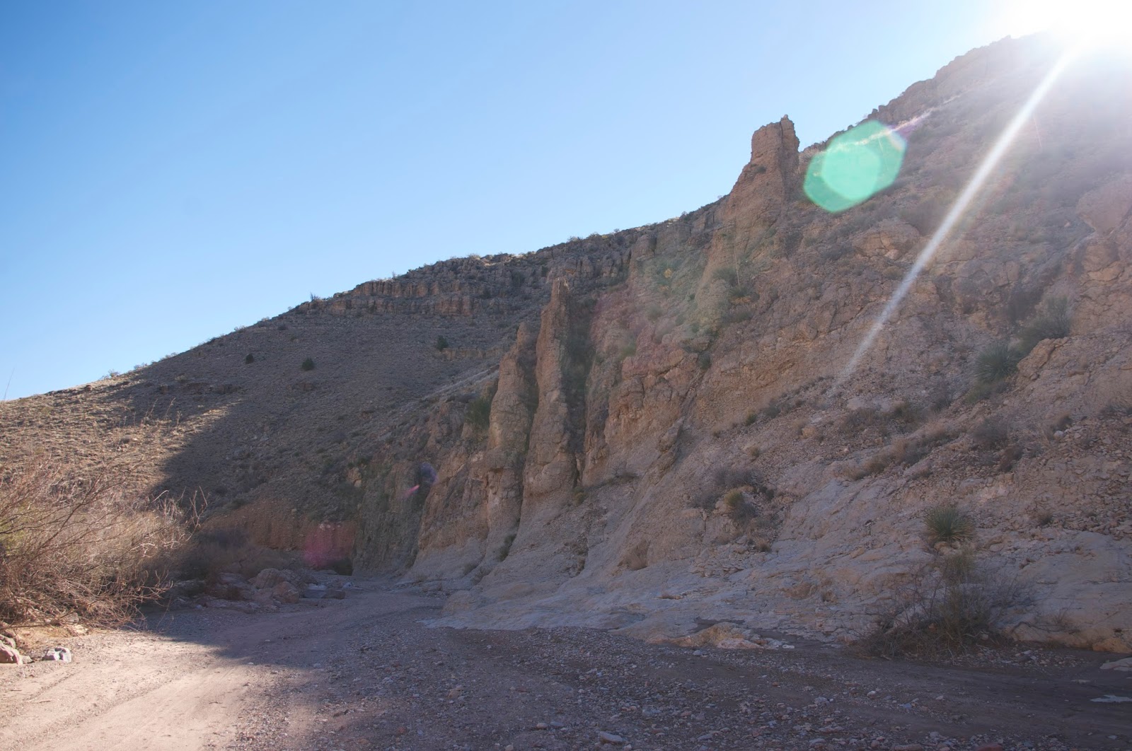
Most of the area, like the towering cliffs in Buckle Bar Canyon is made of a crumbly, boulder conglomerate, so these areas of harder rock stand out.They had the perfect dark brown patina, and many flat faces  that  seemed to call out for some ancient artist to do his handiwork. Alas, there was none to be seen, but I was lucky enough as we returned to catch Buckle Bar Canyon's cliffs with that magic light that so often evades me.

 
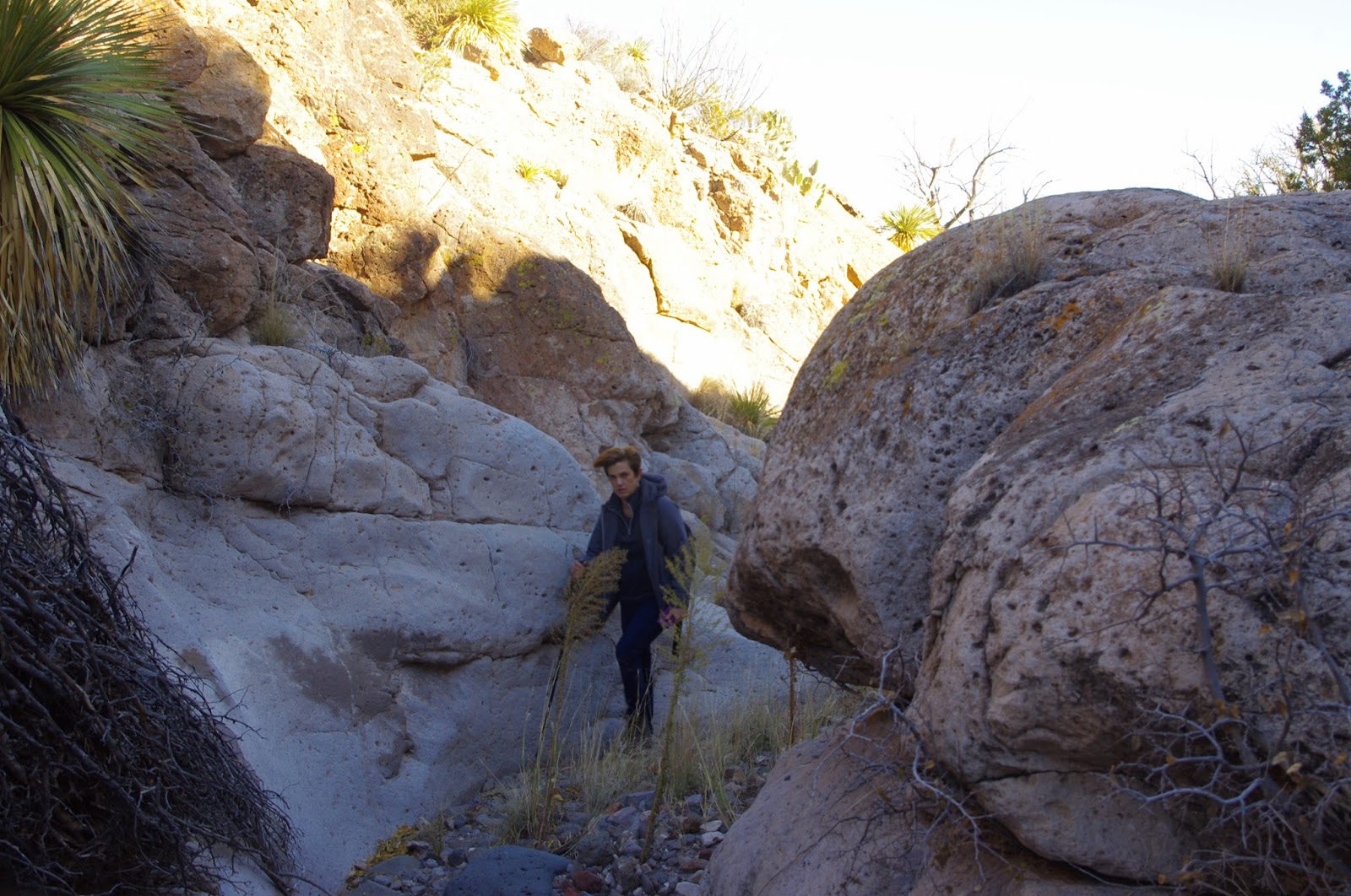
The second day, we went  out  to look at some canyons on the northeast side of the hills. We went up one squiggler and down another. No rock art, but I did find an old prospect( or maybe a dig by some rockhounds) in one of those seams of black and clear quartz crystals that are seen throughout much of the  area( I've seen similar veins in Green Canyon and in tributary of Buckle Bar Canyon). We did come across a  nice mano in the big arroyo that runs on the  south side of the hills. It was only the third one I've found in  the many years I've been hiking out in the desert. Seamus chased bunnies and jack rabbits.  The wind was in respite. It was warm, warm enough that that snakes were still leaving their  paths in the sand,  and I wished I had more time to explore down the big arroyo but had to return. I saw when I got back that I had miscalculated and explored two different canyons  than the ones I had intended.

 Friday (Christmas Day) we went out again in the wind and sunshine finding two little twisting, turning wonders: one with dwarf hackberry trees and conglomerate cliffs, and the other with tight bends in the bright sand. No rock art again, but another good walk.So far I've had good luck finding rock art sites when I was looking for something else, and zero when that was the focus of search.

 Note: The Selden Hills are almost entirely within NMSU's Chihuahuan Desert Research Center land. The property is not posted in Buckle Bar Canyon, but is at intersections and entrances that are along dirt roads on the east side of I-25.This is not public land and although the land was once open to public use and roads along the mesas and in the canyons obviously receive use( we saw many recent vehicle tracks and a dune buggy along the power line road on Friday). Entering without permission  should be considered trespassing.


Labels:

Tuesday, December 22, 2015

Sierra de las Uvas Canyons - Organ Mountains Desert Peaks National Monument


The  trailhead for our hike on Sunday was the  little pass at the very end of the paved Corralitos Rd.(County Road  D 012 ) Well, the pavement doesn't actually end there. The black top does continue up onto Mesa Azur all the way to Magdalena Peak, however it is gated and locked down at the bottom, which is where we parked and started walking northeast down the dirt road in Choases Canyon toward Choases Tank. My original plan was to access Piña Peak from this direction, eventually  using Road Canyon to reach a saddle on the north side and then continue up, but the windy conditions took peak bagging out of the picture for this trip, and threatened to cancel our hiking altogether.  Still, we forged ahead down the road ( a continuation of County Road E 006) past Choases Tank, now with idea of turning back at Road Canyon rather than using it to hike up the western flank of Pina Peak.  A little ways past the tank is a signed intersection, where many years ago on our first trip to the Sierra de las Uvas, we made the turn to the northwest and hiked all the way to Big White Gap.
 At the junction with Kerr Canyon, where the road climbs a small hill, we opted to  walk in the canyon (Kerr Canyon, at this  point, I believe) itself. Shortly thereafter, we found the what seemed like the only windless  spot on our whole hike, tucked against some low cliffs beneath some scrub live oak, to have a lovely picnic.  Some other oaks with respectable trunks grow pressed up against the north facing cliffs nearby. Walking in the bouldery streambed wasn't too difficult, but the persistent wind with occasional gale force gusts kept us from getting too complacent.


At the confluence with White  Gap Canyon( which I think is the beginning of Broad Canyon proper, although Google Maps shows this section as still being Kerr  Canyon,  with Broad not  beginning until after the confluence with Road)  there were pools of water in the smooth bedrock, and a small dry waterfall that we decided to negotiate our way around, although we probably could've climbed down it. This part of the hike is  a little sketchy with regards to private property,  as there is a small rectangular section of here containing the Alamo Well (named for a very large, but now dead cottonwood nearby) and corral and continuing up the hillside to the north. We stayed in the stream bottom, going under a couple of fences, but it may be best to bypass this area altogether by staying on the public access road.

Corral at Alamo Well. Pina Peak left center.

The angular, orange cliffs began to rise up in earnest now on the south side, with enormous slabs of rock forming impressive talus piles at their base.  Soon we were approaching a narrow bend of the canyon with high cliffs not just on the south side but the north as well. The wind howled in this funnel- like section. On the other side of this passage, it wasn't long before we were at the mouth of Road Canyon. I could see the road( Barksdale Road or Dona Ana County E 006) coming down  a hill to where it crossed Broad Canyon, which is where we used to begin our hikes, first down Broad, and up Valles Canyon.


I couldn't tell from Google Earth or my topo maps, but the first part of Road Canyon is a kind of a little slot carved in soft, gray volcanic ash derived rock. There were many pools with a veneer of ice that had to be side stepped or climbed around. Seamus, and expert rock hopper, handled the situation easily. Nessie, our puppy, didn't, and ended breaking the ice in one, and sliding off a rock into the cold water at another. We climbed out at the first reasonable opportunity and now trudged over a hill in a stiff steady wind.


We couldn't find a road  I thought would be there. We encountered fences, which although not posted, I presume delineate the same section of private property. We crossed an arroyo that is Chivatos Canyon and went up a second hill. Finally, we went through a little used gate( it had small juniper growing in it)  where the " road" on either side was all but invisible. We were back near Alamo Well and now opted to stay on the road, first the section we didn't use on the way down, and then retracing our route all the way back to the truck. The  topographic bowl around the confluence of Kerr and Choases had milder winds, but otherwise it was steady stiff breeze in the valleys.  We were glad we hadn't tried to climb any peaks as we listened to the wind accelerating to even greater speeds on the mountain ridges above.

 I looked for rock art, bed rock mortars and other signs of prehistoric people on this hike, but was disappointed not to find any, even though there are several places where they can be found nearby. It might be nice to do this hike in the early spring or fall because of the  variety of deciduous trees (hackberry, soapberry, ash, desert willow) to  be seen  with leaves still attached. If I return to climb Piña Peak, I will drive to a point much closer. The road is drivable with two wheel drive in dry weather.The worst part is the initial descent into Choases Canyon, after which it improves considerably.

Labels: , , ,

Wednesday, December 16, 2015

Green Canyon Box- Caballo Mountains


I've been looking at the several large arroyos that run down from the Caballos between the I-25 river crossing and the Hatch exit every time  I would drive by for the last year or so, with idea of a winter hiking destination on my mind. Garfield Canyon, Mcleod Draw and Broadhurst Canyon didn't really spark much interest with their lackluster topography. Green Canyon, with its deep box canyon  that actually cuts through a detached  western  ridge of the Caballos, containing  two acute turns so it's shaped like a backwards "Z" , did look very interesting as I did my reconnaissance on Google Earth. The many mining prospects that are scattered throughout the area  helped the cause as well.
 Off we went on Sunday, Andrea, Seamus, Nessie and myself, also known as " the pack," driving north on I-25. Arriving at exit 51 we got off and immediately headed east on what is initially a very good dirt and gravel road ( good enough that I had driven quite a ways on it several months ago in the Corolla). Further on,  the crossings of several small arroyos  weren't so great, and we stopped and parked just before reaching a heavily eroded, steep hill that seemed to be whispering: " you need four wheel drive." We walked up it with the no problem and as is often the case the road quality thereafter was greatly improved. We passed several rough roads that went off to mining prospects on the hillsides, as the road wound around and up and down through contrasting sedimentary beds of gray and deep rusty red. Some of the red layers had blue gray veins running through them. We passed an easy walking side canyon that, we found out later, would have brought us out right at the upper end of the box. Instead, we chose to climb up and over another small hill.

 Finally, we reached the wide upper arroyo of Green Canyon and began heading downstream.  I saw a bobcat cross the streambed in front of us ( only my second time to see one of these shy animals in New Mexico)  so we leashed up the usually free roaming Seamus. We came to the above mentioned  side canyon on the south, which I would use if I did this loop again and soon after we were in the box proper, where the first thing we saw was this double arch formation.There was also what may have been a grinding hole, but no rock art as far as I could see. We had our lunch on a limestone boulder, sitting in the sun on this cool winter afternoon.


We passed through a gate ( actually under) in a barbed wire fence across the stream bottom.The canyon narrowed and deepened  and was quite impressive as we continued on. Rough limestone bedrock, now worn smooth and polished a whitish gray, was ample evidence, along with sand deposited by floods well above channel bottom, that  this canyon has significant flow at times.This  may be why it has a large flood control dam, just to the east of the highway. Puddles lingered in the bed rock and through the narrowest section,  water seemed to trickle through sand, both were remnants of the previous day's storm.

 Through some sections were veins and infilled cracks thick with clear, white and black crystals similar to some I'd seen over in Buckle Bar Canyon.  I didn't see much in the way of fossils, but I wasn't looking real hard either. After coming out of the second big turn, I saw the remnants of an old plank bridge( at least I think it was from a bridge) above us on the north side that crossed a rough, narrow and intriguing little side canyon. A short ways down, we saw a rusty old chute and the scattered lumber that once held it  in place laying on the south hillside.Unlike many desert canyons in our area this one had very few of those large junipers clinging to its sides. Perhaps it's too wide and open to sun.  It was similar to Broad Canyon in that respect.There were a very few deciduous trees like hackberry, mesquite and soapberry, however.

  A pair of ravens( or were they crows?) that had been following us  along  finally sat in some bare branches below the cliffs like a couple of lovebirds, as we bid farewell to the box.We took an arroyo that was intermingled with a very old road as our exit to the south. Coming to the top of a small hill,  we could see that we were on a beeline for our red truck.We crossed  over several small rills, a little difficult with Nessie on a leash through the low thorny brush and cactus. Seamus chased a jackrabbit, but soon realized the futility and returned quickly.Climbing one last hill, we completed our day in the desert. Our loop was somewhere between 5 and 6 miles I estimate. Another potential hike out here is climbing the peak about a mile north of the box using old mining roads.
Note: I enjoyed this hidden little canyon, although it may not have enough to recommend it in the way of highlights for some folks.  I did see some tire marks on a few boulders, but I don't think this canyon sees a lot of vehicular recreation, except for a once a year get together of rock crawlers that usually occurs in October.


Labels: , ,