Sandia Crest Trail( FT 130)- Sandia Mountains Wilderness, Cibola National Forest


 |
| Tunnel Spring |
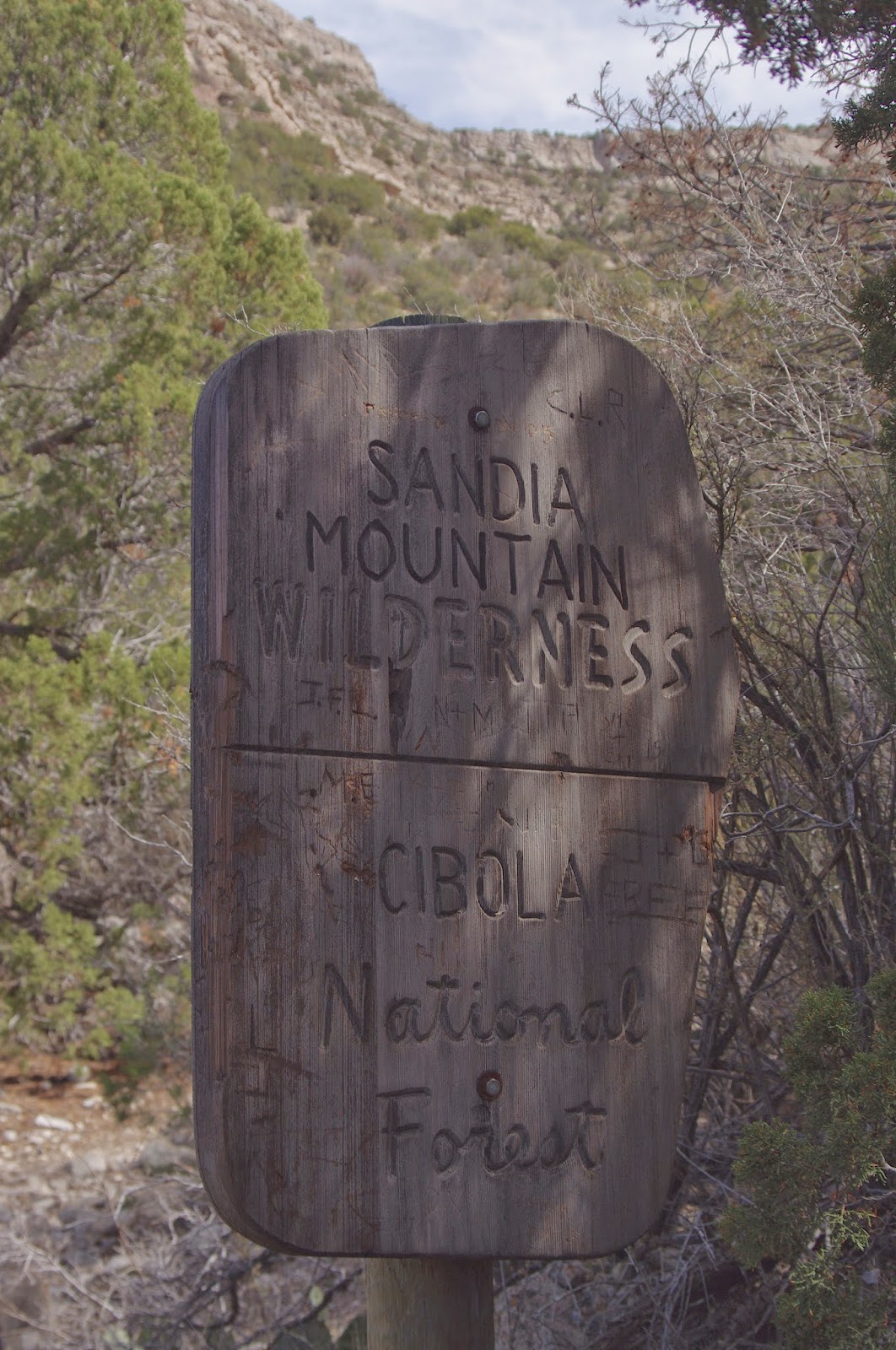
 We did this hike this past sunny Sunday( 3/22/15), starting out at the Tunnel Springs trailhead on the north end of the mountain range near Placitas,NM. Early on, right at the Sandia Mountains Wilderness sign, a use trail( called the Al Orno trail by some), branches off to the south, going straight up a long ravine. We didn't take it, but continued on the main trail east, side-hilling in and out of small drainages right about at the level of geologic uncomformity which separates the precambrian granitic rocks from the much younger paleozoic limestones. We had views of Placitas below. In the middle distance were the Ortiz Mountains, and far to the northwest, the still white peaks of the Pecos Wilderness. Large mormon tea bushes grew along trail.
Eventually we turned back to the south heading up the side of a narrow ravine that is a tributary of Arroyo Colorado. On top of the gradually sloping mesa, we continued along amongst the pinon and juniper forest. One thing that surprised me here- was the complete lack of larger trees( ponderosa pines, douglas firs etc). After all, we were on north facing slopes on the north end of the mountain at an elevation I would have though was high enough to grow a forest of larger trees. I pondered this, and finally concluded different factors must be at play than in our forests here in the southern part of the state, where heat kills, and where there is often remarkable contrast in vegetation between north and south facing slopes. Here, further north, perhaps the colder north facing slopes don't allow for larger growth. Perhaps, also, the range is so narrow, unlike the Gila and Lincoln National Forests down here that only the very highest elevations receive enough moisture to grow large trees.
The bottom line is, this hike is very open, I could see, even in mid- March, how heat could be a substantial limiting factor on its use.
Eventually, the trail climbed back to the west then zigged to south and had us walking in the shadow of some massive limestone cliffs( here in the shadows at least some larger pinons grew). We passed the trail that comes up from the ravine and shortly thereafter stopped at the bottom of the V the trail was making and ate our picnic lunch. We had one group pass us. We saw another that we had passed opting to take the ravine trail down.
After lunch, we continued upward until finally views of the high elevation peaks, the very head of Agua Sarca Canyon, and in the distance snowy Mt. Taylor came into view. This was our turnaround point. Right when we were coming back to the where the ravine trail goes down, we met a man who had come up. We inquired as to what the trail was like. He must have said " steep" one too many times, because my quickly decide that it was not going to be good short cut for her, and we went back the way we came.
This was okay hike, but needed a lot more going on to be a good or great one.We did see six or seven small groups of humans and canines in about 4 hours, but it is definitely not crowded despite its proximity to Albuquerque and its suburbs, which was a plus. It was good to get out in the mountains- as always.


 |
| Mormon tea |
Labels: hiking
posted by Devon Fletcher at
2:58 PM
![]()
![]()


1 Comments:
Very nice, and I never did that hike before I moved. Your hike looked too low and dry for doug firs, I think those are over 8000' in the Sandias, at least at the S end where I lived...
You should try Tres Pistolas / Three Gun Springs from Carnuel to South Peak next time, before it gets hot. 4 life zones in several miles, desert grassland and live oaks at the bottom to subalpine at the top (10K'?).
Post a Comment
Subscribe to Post Comments [Atom]
<< Home