Friday, September 19, 2014

Hike to Texas Canyon- Organ Mountains

 My hike to Long Canyon last Saturday brought to mind another walkabout  I did more than 10 years ago to another canyon well off the beaten track in  Organs. I had casually remarked while participating in  Sierra Club hike( to what location I don't remember) that   I was interested in finding the remains of the old gold mine in Texas Canyon.  My idea was met  with surprising enthusiasm by a few of the other hikers and the very next week I found myself heading out early on Sunday morning with three new acquaintances  driving over to Aguirre Springs to  make the trek to that very same place. We started out on the Indian Hollow trail, eventually having to make our way up the bare expanses of granite just east of Sugarloaf. From the top of that ridge we started down a ridiculously steep , as well as brushy, ravine. Mostly we were on our bottoms until we reached the bottom in a small clearing surrounded by large oaks. There was ample evidence( scat,  clawed trees) that this spot was visited by a mountain lion from time to time.
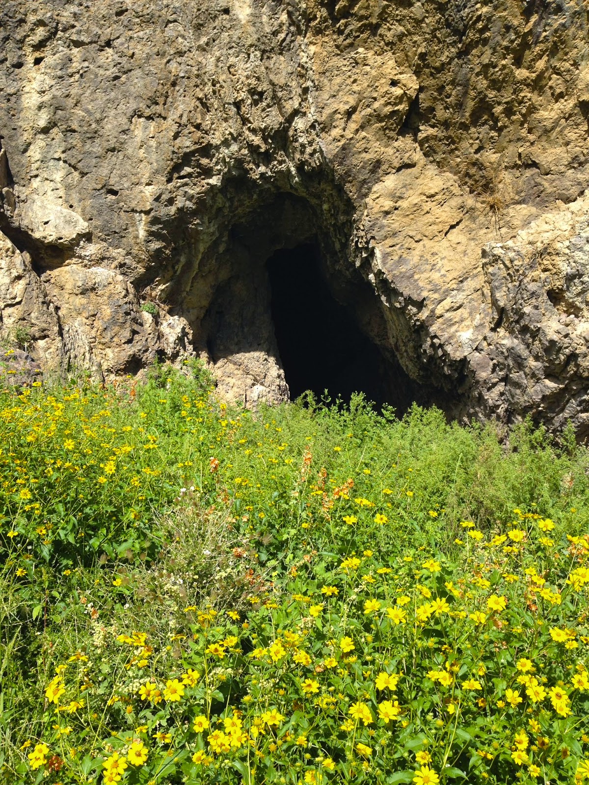
 We broke out of  the thicket into the bouldery arroyo called Rock Springs Canyon. Here, we were treated with views of Sugarloaf from a vantage point rarely seen except  by the most intrepid of hikers and climbers( I say this with some confidence, because as much as Sugarloaf and the rest of the Organ Mountains are photographed, I don't believe I have ever seen this "other" side in any search of images).


i
 On we continued across the the broad alluvial deposits between Rock Springs Canyon and Maple Canyon. This section would  appear to be easy walking if one were looking at  the widely spaced elevation lines , seemingly free from crossing drainages , that is the image from a topo map.  Unfortunately it is  actually cut through with several small,but steep sided  gulches that have to be crossed, that made our trail less  hiking  pure drudgery.
  Arriving at the the base of of the ravine opposite Texas Canyon were some large ponderosa pines, which are always lovely to see wherever you find them in the Organs. We then made our push towards the saddle. At the top, the wind howled, as we ate, while looking down into Texas Canyon. One companion and I made our way down  shortly afterwards. We thought we spied some tailings piles, quite aways further down,but nothing else from the old mining operation was visible in our immediate vicinity. I wanted to explore further down,but  the prospect of  cross country hiking in the dark on our return trip,plus the fact that we were venturing very close to a sensitive area of White Sands Missile Range, and my fellow adventurers waning enthusiasm, meant that the more sensible option of beginning our return would prevail.
 I found a nice chunk of quartz crystal, back up on the saddle that  I gave away to one of my fellow travellers, and then we were on our way.
 We happened upon  a trail of sorts that took us up through the catclaw brambles to the top of the ridge that extends out from Sugarloaf. Unfortunately, it vanished at the top, and we once again were making our way down a treacherous ravine of unstable rock.  I was little put off by  one friend that seemed to enjoy this part of trip the most, as I tried to argue, unsuccessfully, for taking a safer route down.  We made our way across a pasture of the ( private) Saint Augustine Ranch. We knew we had accidentally trespassed when  we arrived at the fence dividing the ranch and BLM land. The earth was cooling rapidly( I believe it was January) as the sun set, but we made it back safely to my old Isuzu Rodeo.  I would like to return this area one day, while I'm still reasonably young and fit. I want to see if Maple Canyon  will live up to its name. I'm a sucker  for the fall colors of those beautiful big tooth maples that can be seen in other dark, cool places in the Organs. Note: Only a  portion of Texas Canyon is BLM land. Please do not  trespass onto private land or military land on this hike . Be forewarned and be careful if you go.


Labels: ,

Wednesday, September 17, 2014

Upper Long Canyon- Organ Mountains


 I 'd been wanting to do a hike to Upper Long Canyon, a shallow valley indented into the lower elevation ridges of the southern Organ Mountains, ever since I spied it on a topo map many years ago( in the days before Google Earth). I did do a hike back then to the  lower reaches of Long Canyon( see "Slot Canyons" in this blog). The reason I didn't do upper Long Canyon at that same  time is because I didn't have the rock climbing and or rappelling skills to pull it off( I still don't). You see, they are separated by 100 foot or more dry waterfall. The upper canyon is almost like a hanging valley. It starts out as a gentle, high desert, meadowy stream course and continues like this for several miles before proceeding to the abrupt drop that leads to a short slot section, which then opens into a boulder filled arroyo bordered by towering sheer cliffs on its west side.
 Well, I finally got the chance last Saturday( 9/14/14). It was seventy degrees and overcast, and even though I knew I was bound to see a few rattlers,  it seemed perfect weather to cast aside my ideas regarding Summer hikes in the desert( the main idea is: wait until winter), just  to see this place in the fullness of the blessings of our rainy season. I was I glad I did. I did have one small rattler coil up in front of me on the return trip, but I was oddly calm about it ( exhaustion will do that) and it hardly dampened my enthusiasm for the whole experience.
 I started off at a pull out just before two bullet riddled warning signs that list the dangers of traveling into this supposed former artillery range. Those signs were not there years ago and in the past this area had not been deemed off limits. It was part of buffer zone, a kind of wide boundary area between BLM and US Military lands, and was used frequently for recreation.Users were on an honor system not to stray to close to military operations,  and from my own experience and  that of others I know, we had been left alone. I can't say exactly what the situation is now. Something must have prompted the posting of those signs.  If you want to visit do so at your own risk. The area is reached from the Mesquite exit on  I- 25, heading east on the paved, and then two lane all weather  gravel road. Past the landfill and power lines it become one lane dirt. Past the parking areas for the Sierra Vista Trail it becomes a rough, rocky, unmaintained way, which may require high clearance, and when wet, most likely four wheel drive.
From my truck it was a steady uphill trudge northeast to gain access to the nameless canyon that would take me up to small saddle and then over into Long Canyon. I've decided to name this canyon West Finley Canyon because it is a tributary of Finley Canyon, as is Long Canyon itself, which feeds into, along with many other small" canyons," Mossman Arroyo.
After a mile or so I entered the canyon and began rock hopping along. It was relatively easy going, although the vegetation was thick in spots, especially some vine like species that were frequently grabbing at my ankles. Eventually there were pools of water here and there in the bare, reddish brown volcanic rock, with many butterflies, moths, bees and flies hanging about. Wrens, towhees and desert sparrows flitted about as well. I even saw a couple of mule deer making their way downhill( and away from me) and it warmed my heart to see the desert so alive.
 I was looking up ahead toward a likely resting spot in the shade of two alligator junipers, when something wonderful happened. A bird flew out from the trees. A large bird. This had happened to me before on several occasions when I inadvertently rousted great horned owls from their roosts, while hiking in other desert canyons and arroyos. But this was no owl.  As it got closer, probably no more than 10 feet above me, I realized, as I noticed its yellowish markings under its wings and on its neck and its tremendous size that this wasn't even one of the many hawk species common to our area. It was a golden eagle. It was pure magic watching it go by so closely. It then drifted out into the desert as I briefly hoped ,for some crazy reason ,it would return. It didn't, of course, and I continued on, uplifted.
West Finley Canyon.
I took this photo moments before the eagle flew out.
 Unfortunately the phone was back in my pocket
 I began to despair a bit when the canyon seemed to lengthen, the clouds parted for good, and the sun shone through making the temperature shoot up at least 10 degrees or so. I was also at the large bowl that marked the end of the canyon and would now have to trudge up the steep hillside. It was very slow going with rests, at first at every 5 steps, and then every 10.  It was worth it, despite the heat, the sunburn I knew I would have ,and  the tiny cactus thorns in my hands. Upon reaching the saddle, I was greeted by the lush valley of high grass and wildflowers that was Upper Long Canyon. A very few green junipers dotted the green hillsides. Others were dead, some burned from a  fire a few years ago.It was hard to believe, and certainly impossible to tell especially when looking up at the rugged western face of this ridge that this enchanting little valley could even exist, but it does and I was joyful to see it for the first time.
 I first walked downstream, where the terrain begins to get a little more rugged as I approached the break between the upper and lower canyons. I walked out onto a prominence  and took in magnificent views of the towering gap that marks the entrance to the narrow box or slot section of the lower canyon. I then climbed down a small dry waterfall and crunched my way along the winding, gravel streambed that was bordered with many good sized oaks. At the last curve I saw thick moss growing on north facing cliffs, and wondered what it would be like to be here on the rare occasions when the waters run through and over the falls. Coming to the precipice of the high waterfall, I inched as close as I dared and looked down to where I had turned back many years ago.
Near the saddle

Heading downstream

Views of the gap

Franklin Mountains framed by the gap

At the high waterfall.
smaller waterfall
 I made my way back upstream along the easy walking path of the streambed. I checked out a cave  that was perhaps 20 or so feet deep with several alcoves at the rear. The ceiling was blackened from many fires, and even though there were some very recent burnt logs at the entrance, I hoped that at least some of them had been from ancient times. I continued on, just soaking in this magic place, making plans for return trip, perhaps from the north end.  I knew I would be turning back sooner than I wanted. It was  Saturday evening and I wanted to be long out of there before any of  the party crowd that sometimes frequents the area where I'd parked my truck showed up. Note: On my return trip I was treated to sounds of nearby artillery practice echoing off the canyon walls like God's own thunder, which certainly gave me pause.I could see some sort of operation in the distance to the southeast involving a helicopter. This had me contemplating an alternate route( perhaps straight up on one of the ravines on the west side, or from the north via Achenbach Canyon) should I ever return.


globe mallow

Looking down West Finley Canyon . Bishop's Cap at right.


morning glory

Labels: