Tuesday, March 27, 2012

Johnnie Canyon Trail-Lincoln National Forest


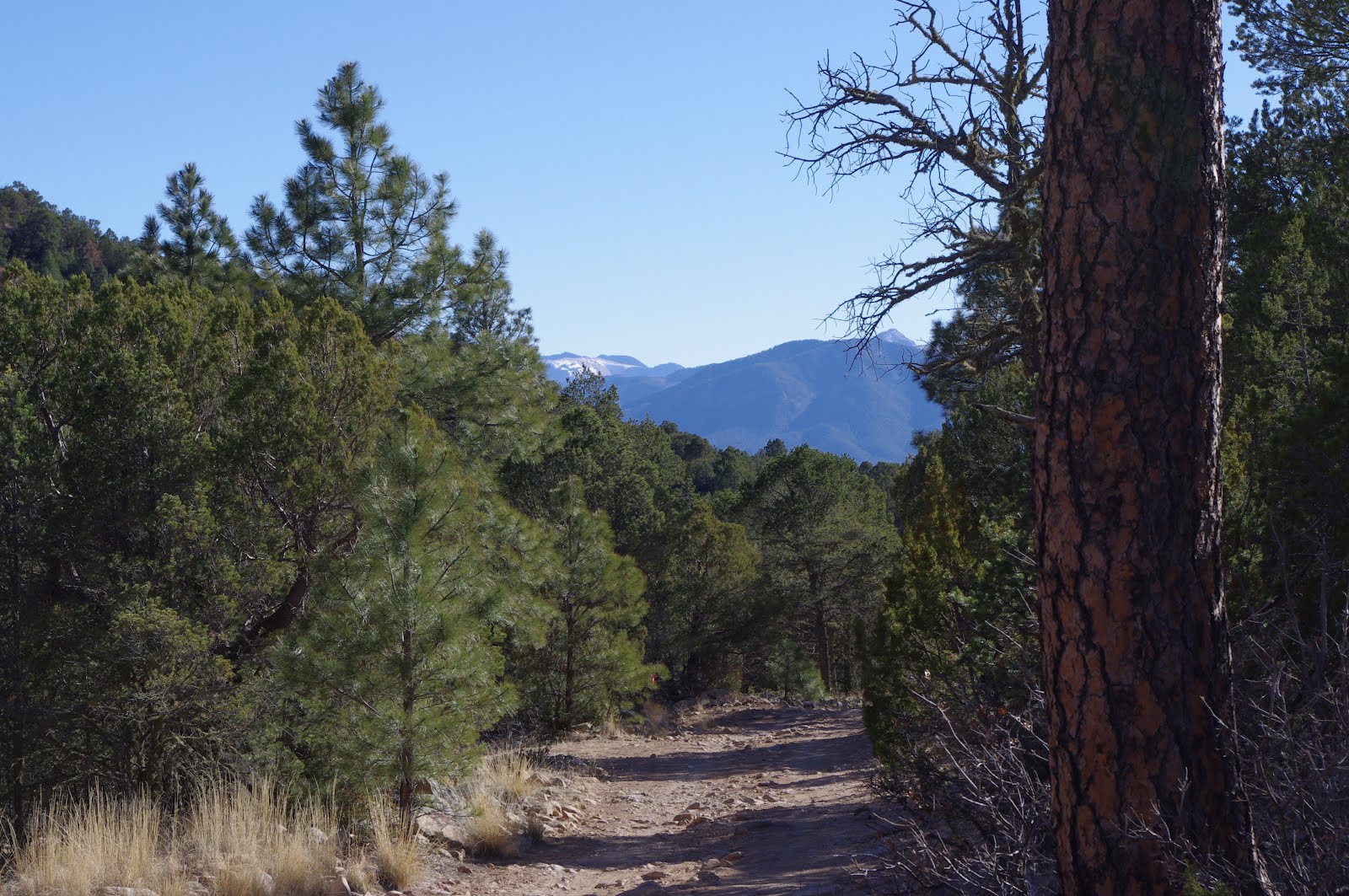
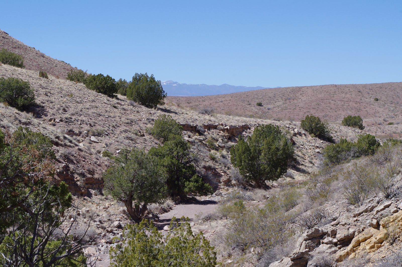
Carrizo Mountain is a massive,dome shaped uplift just to the northeast of it's namesake town of Carrizozo. It towers over 4000 feet above the yucca studded grasslands, and dwarfs the other mountains in it's immediate vicinity. Despite it's visual prominence and it's proximity to a highway crossroads, FT 74, the Johnnie Canyon Trail is it's only official route.The first part of the access road (FR 441) on the southeast side of the mountain,is county maintained and in great shape. Once we drove through the O Bar O Ranch and onto Forest Service land proper, things got bad fast. If you're driving anything less than very high clearance, and maybe 4 wheel drive( depending on the weather) you would be advised to pull out and park at the first opportunity. As it was,we only drove a short ways before parking and walked the last 3/4 mile to the trailhead, which sits in large clearing and has sturdy metal sign pointing the way up the mountain.The way to go seemed obvious enough,but after walking a mile or more on the boulder strewn path, I began to wonder if I was on the trail or in a stream bed. Perhaps the bottom part of this trail sees a lot of horse traffic which can remove thin soils pretty quickly. It also might have started life as an old road as well, and has become an alternate stream channel with the rainwater stripping away the soil down to the rocks. Whatever the reason , it made for unpleasant walking and we were glad when we left the pinon -juniper zone of the forest and entered the shade of the tall pines and firs and began walking on a thick bed of pine needles.
     There were some beautiful camping spots in this stretch. Further along the trail begins to steepen as the canyon narrows and the downed trees across the trail became more and more numerous and a bit of nuisance.Still, there were some beautiful clearings along the way where the sun shines through and the shrubs and grass showed the green of spring. There was one spring as well that had a very meager flow. A few jays and juncos flitted in the trees, and there was the occasional talk of a raven. We startled something that ran up a hill,but never saw what it was. The trail had abundant bear scat that seemed to have been from the previous fall after a season under the snow,but some of it may have been fresh.
      The trail starts to switchback right after being almost completed obscured by a thicket of downfall that has to be negotiated around. It's pretty clear going as it levels out at a large park like clearing which is on the ridgeline,but directly behind the high point and about 700 feet below it. Views to the west and north west were very limited. Well,they weren't any really,except tiny fragmented peeks at the lower slopes and the grasslands below. Perhaps, if we hadn't had to walk that extra distance to trailhead, we would've had more time and energy and went for the peak,the trail to which headed off to the south.  On the way down there were some views to the back side of Sierra Blanca to the south and over to Vera Cruz Mountains to the east. It was a good hike. Total distance was little over 8 miles. Elevation gain was in excess of 2100 feet( 6,700-8800). You'll need add a couple miles or so for the round trip to the peak.The sign at the trail head says Carrizo Peak 5 Miles, that's if you can drive all the way to trailhead.

Labels:

Sunday, March 25, 2012

Quebradas Backcountry Scenic Byway


We drove west from Valley of Fires through the juniper studded Chupadera Mesa and the foothills of the Oscura Range to reach the Quebradas Byway about 11 miles east of San Antonio on NM 380. This is a well maintained dirt road that skirts the edge of the BLM's Sierra de las Canas Wilderness Study Area. For 24 miles it winds in between steep peaks of colorful sedimentary rock,climbs narrow ridges, and dives in and out several arroyos, until it finally brings you back down to the Rio Grande just north of Socorro. The mountains are reminiscent of Caballos near T or C, the Robledos here in Las Cruces, and the San Andres Mountains . There are many of the same Paleozoic sedimentary formations. The green shales, the gray and blue limestones,the yellow , brown and red sandstones make an extensive pallet, and I wished as I drove that I was seeing it all in the last light of a winter day instead of the bright sun of a spring afternoon. We got out and walked to one small box canyon and saw a snake's path, a tiny kinglet, a vicious,bubbly low growing cactus and bluish limestone streaked with a myriad of white calcite(or maybe quartz?) veins. The junipers were bright and it was already hot,but there were still few signs of spring. There are no trails here but almost all of the land is open to exploring. The larger arroyos we crossed( one even had flowing water) looked especially interesting. Make no mistake though, these are desert mountains, best visited between October and April.We might have been able to walk more ,but the afternoon sun soon took its toll on our very black Scottie dog. Later, as we got back in the truck and drove on ,we saw several areas of reddish sand dunes, nearly vertical sedimentary beds, and the long ,steep wall like main ridge of the Sierra de las Canas. If I lived in Socorro, I know I would be out exploring this area every winter, just like I do with the desert ranges closer to home. As it was , it was nice outing in an area, that with so many larger more well known mountain ranges nearby, is an all but forgotten little pocket of our state. I only discovered it when I happened upon an old BLM map that I had filed away.Note: The BLM has a brochure and geologic guide to this drive available online

Labels: ,

Valley of Fires


We camped at the BLM's Valley of Fires campground for the first time this week.The campground is in two sections. One,where we camped, atop a sandstone kipuka with views across the lava flow toward Chupadera Mesa in the west and to Nogal Peak and Carrizo Mountain to the east,is for trailers or tents with water and electric at most sites.The other, down in a hollow right up next to the 10 -15 foot walls of the lava flow itself is more cozy and rustic but is for tent campers only.We walked the paved nature trail a couple of times,changing directions on the loop. We also walked the grounds and climbed the little hill twice.The wind was little strong our first day,but cooperated the rest of our stay.You really can't beat this place for convenience. The small town of Carrizozo is nearby with a few gas stations, a couple of restaurants, a small grocery store and even a golf course. More importantly, this campground can serve as a base for exploring the Sacramento Mountains and the Capitan Mountains and their wilderness areas. It seems like the perfect place for camping at those in between times of the year,like now, and yet there was never more than seven campsites occupied during the days we were there.The stars were spectacular every night.The sunrise over Carrizo Peak and sunset over the distant Oscura Range opened and closed each peaceful day beautifully.

Labels:

Saturday, March 10, 2012

Caballo Mountains- ridge walk


Road to Timber Peak


Burbank Canyon, Caballo Lake from ridgeline
Timber Peak
We've also done the ridgeline walk along the jeep road at the top of the Caballos. We drove only two-thirds of the way up the steep, switchbacking, only moderately rough, but nonetheless still a bit nerve-wracking road that is used for access to the communications towers on Timber Peak.  There was a little bit climbing left and then a mostly level walk with great views of Caballo Lake and the Black Range to the west, and the Jornada del Muerto and the San Andres Mountains to the east. We didn't opt for the short climb to Brushy Peak,which is the destination of the hike as described, in Greg Magee's Day Hikes and Nature Walks in the Las Cruces- El Paso Area. Instead, we took a side road to a small valley of where there were some good sized piñon pines for shade ( a pleasant surprise in these desert mountains), and looked at a few of the ever present mining prospects, then turned around.Note: the adventure of this hike is getting to the starting point. The back(east) side of the Caballos is a maze of roads, trails, routes and ways. Some are very good. Some are horrendous. Most of route leading here is on good( by southern New Mexico standards) roads. . . most. If you find yourself onto something very sketchy, there was probably a wrong turn.

Labels:

Thursday, March 8, 2012

Apache Gap, Burbank and Flordillo (Cable) Canyons- Caballo Mountains


 Oddly level area near Bat Cave. View is to the Black Range's Emory Pass

Flordillo Canyon

View from Flordillo Canyon hike

Way back in Burbank Canyon looking south toward Brushy Peak


Burbank Canyon looking southeast
Bat Cave
Natural Arch seen from Burbank Canyon
Near the top of Apache Gap Canyon
Another good hike in the Caballos is Apache Gap Canyon.We did this one a few years ago while camping at Caballo Lake State Park's Riverside Campground. The canyon is accessed by an unmaintained dirt roads on the southeast side of Caballo Lake. We ended up parking a few miles in before the arroyo gets thick with boulders. The road/trail initially takes off up on the hillside,but then returns to the canyon bottom.Finally it leaves the canyon again, staying on the north hillside all the way to ridgetop. We could see roads branching off to the north and the east. The views were great.
    Burbank Canyon was our first foray into hiking the canyons on the west side of the Caballos. It  is wide and deep  and nearly splits the main ridge line. As it is, it visually divides it into the northern Timber Peak section and the southern Brushy Peak section. It is accessed by some good county roads on the east side of the lake, however the road in the canyon is not great. The beginning of the Burbank Canyon road may be on private property as well,so you may need to work around to it whether driving or hiking.There are some interesting sights along the way: some derelict heavy machinery that I can't believe someone bothered to drive up here, the words " Fuck the Gold" deeply etched in a stone perhaps by the same hopeful miner who abandoned his bulldozer, a natural arch high up on one of the arms branching out from Timber Peak,and I believe it was in this canyon where we saw an old wooden case of dynamite sitting mutely under a juniper tree. This is a long hike to get to the back of the canyon, where the terrain is gentle enough( but not that gentle) where if one had the energy and the desire, the top of the range could be hiked using a ridge on the south side.
        Flordillo Canyon, and nearby Bat Cave Canyon are in between Burbank to the north and Apache Gap to the south.The large bat cave can be seen to the north near the top of this hike. Further back there is a large steel cable strung from somewhere high on the cliffs perhaps used by a miner to access a mine or transport ore. You may hear or read of Flordillo Canyon being referred to as Cable Canyon because of this.There are mines all over these mountains and folks still prospect for gold and other minerals(we met a prospector on our hike in Apache Gap). You may see stories of folks getting some warning shots fired at them for getting too close to someone's claim. These stories could be true or it could be some miner circulating the stories as a way of scaring off folks. We've never had any problems and the few people we've met have been friendly, but just as precaution remember some of the mines may have current claims,so,in addition to staying out of any mines because of the numerous dangers,leave anything that looks like a claim marker alone (stakes,cairns,fluorescent ribbon) and don't wander around an obviously staked out area. All of these hikes are on steep roads made for driving,not hiking( the one to Bat Cave is the worst), there is little shade except the occasional juniper. Water is scarce, except with winter snow, or maybe with the summer rains,but please don't hike here in the summer, not only is it dangerously hot,but you have better than average chance of getting struck by lightning,should one of our monsoon thunderstorms roll in.

Labels:

Tuesday, March 6, 2012

Palomas Gap - Caballo Mountains


This route, an old, narrow toll road, is well known to those with Jeeps, ATVs and dirt bikes, but is probably not hiked all that often. One of the most obvious reasons why would seem to be the necessity of one of those types of vehicles just to get to some kind of reasonable starting point to begin walking.Well, this is not entirely true. We made it to our starting point on the east side of the mountains in a 2 wheel drive pick-up. The problem was was just finding our way among the maze of roads to get there. I drove past two turns and ended up using a road that turned out to not even be on the topo map I used for reference to get there. All but this last couple of miles on that road weren't particularly rough. I was using my hand held GPS with points loaded from my AllTopo software and I still wasted a half an hour or so getting off and then back on track. Since this is so far from towns and highways, I don't know if conventional GPS systems that are in use in so many vehicles will be of much use.
The hike itself is spectacular. We started out amongst the low red hills that run along much of the east side of the Caballos. These hills form a parallel low elevation range which forms a barrier that redirects the drainage from the main ridge of the Caballos for many miles into Palomas Gap Creek which flows to the north and then west cutting completely through range. We hiked along the road, which crossed the creek bed a couple of times before beginning its gradual ascent going higher and higher, a small scratch in the massive limestone layers on the south side of the Gap. At its highest point we were probably 500 feet above the dry waterfalls of the creek bottom, with peaks rising 1500 feet above us. We chatted pleasantly with a fellow who stopped whatever adventure he was bound for on his ATV, and I thought I might need to get one of those things for my old age. We made it over to the point where the road begins to do some really long descending switchbacks on the east side. We could see the Rio Grande, the small town of Palomas, and the snow covered Black Range beyond.       
   After we'd turned around and were heading back, I thought if it weren't for difficulty of access and it's being so far from any population center, this canyon would be a destination. But it isn't. The lone ATVer was the only person we met. And as almost always, it seemed most right to enjoy the desert in solitude. Note: this hike is almost entirely without shade, except in a few spots where it is formed by the road cut itself. Also, although the canyon itself looks like an interesting hike, there several high waterfalls that may require rapelling with a rope or at least some extraordinary rock scrambling skills.

Labels: