Monday, March 28, 2011

Caves

We met some folks on the way back.Talked for a little while. They told some tales of mule excursions  into the most rugged areas of the Black Range on the Animas Divide Trail,East Curtis Canyon, the crossover trail from the North Percha, as well as the upper reaches of the Mineral Creek trail. Just the kind of thing that gets my imagination going for  future excursions. It also gets my frustration going at not living closer to the mountains going as well( sigh). Oh well,everything I've heard or read about these places makes them sound unpalatable even for the most seasoned backpacker( If you don't believe me, check out Hiking the Aldo Leopold Wilderness by Polly and Roy Cunningham).  I've actually hiked trails like Water Canyon and several others which are still "official" trails in the Black Range, as well as quite a few unofficial ones that provided a little more adventure than was necessary in the way of washouts,brush,downed trees,rockslides and absent tread( sour grapes now concluded).
     They also told of some caves. One is on North Percha, which they gave me some directions to, although,I probably need someone to point it out on the map. The other, they said, is on Mineral Creek,but they didn't know where.There are many intriguing holes and alcoves including one very large one in the cliffs just below the ridge with the natural arch on top. I've also heard of Robinson's Cave, Mad Hornet Cave and Coffee Cave, which are all supposedly in the Black Range,but I don't know where.Also in the Black Range on the west side is the cave at the Royal John Mine, located  at the head of Cold Spring Canyon( not 100% sure on the location, I have not visited there). This cave has a  small pond inside it. Artifacts recovered many years ago suggested that it had a ceremonial purpose to the Mimbres Mogollon people who lived in the valley.There are two small caves in the Bishop Cap area,one high up on the west face of Bishop Cap proper. . Anyone with information about these caves or their experiences on the above mentioned abandoned trails,please comment.

Labels:

Mineral Creek-Gila National Forest


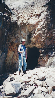
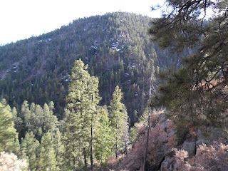
We hiked Mineral Creek in the Black Range on Sunday, This is the Mineral Creek that crosses FR 157 South, also called the North Percha Road. I say this because there are at least 3 Mineral Creeks in the Gila, two of them in the Black Range. Anyway, we've hiked up here maybe four or five times. It's a pretty little road that's actually in drivable condition,if your vehicle can make it past the first few hundred yards of streambed that are the beginning of the trail. Otherwise,you can walk it like we do. There's also a forest sign just past the crossing which says " Forest Trail" with an arrow pointing to a gully and some brush but certainly not to the trail. It's been such a dry year,there was little water in the creek already. The nice waterfall less than a mile in was just a trickle. The old road eventually forks. One branch goes down to the stream. The other takes you high above to an old mining prospect on the cliff side.You can continue past the mine for a little ways, where you can enjoy the view of the upper valley of the creek. A little farther the " trail" becomes overgrown with mountain mahogany and other brush, and has frequent spots where the loose rock has erupted out of hillside making the going even more difficult. A few years ago I thought I could follow the trail to where it goes back downhill and crosses the stream bed ( above a larger waterfall),but it just got fainter and more brushy,until I reached a large washout and turned around.  If anyone out there can clue me in if this section of the trail exists anymore or has a reasonable alternative for reaching the upper canyon please let me know.


    Another trip I tried to negotiate the boulders and the brush down in the stream, trying to reach the base of the waterfall, but realized it was going to take a lot longer than I estimated, and turned around again. No such adventure on this trip. We simply turned around and walked back enjoying the cloudless skies and perfect temperatures. It was a beautiful spring day, but my anxiety began to rise anyway as I thought about the what it will become of the forest if we don't get some rain soon.IMPORTANT UPDATE: This hike was within the Silver Fire( June,2013).

Labels:

Thursday, March 24, 2011

New Mexico Vineyards


We've really been enjoying visiting vineyards and wineries here in our home state, participating in the New Mexico Wine Growers Association's passport program. So far we've collected 28 stamps.Some places have been just to collect the stamp as we work our way to the grand prize. But, most have been a lot of fun, especially when you can meet the winemakers themselves as was the case at Dos Viejos and La Chiripada. It's also been great to talk to the folks at Casa de Abril, La Esperanza, and Estrella Del Norte and learn how their families got started in the business. The little chain of wineries near Espanola makes for a great,scenic day trip from Santa Fe. In southern New Mexico,a similar trip can be had from El Paso or Las Cruces visiting the cluster of wineries near Tularosa and then going up to Ruidoso for a couple more. One of the more unusual stops so far has been the Don Quixote Winery and Distillery which is located in the middle of the suburban subdivision of White Rock. Probably the most off the beaten path,but also one of most scenic is La Esperanza( pictured above) on Gallinas Creek near Sherman, New Mexico in the Mimbres Valley. They're all very different. Oh, and the wines are good too.

Wednesday, March 23, 2011

Pecos River


The temperature after I left Pecos NHP was still only in the mid 40's. It was still overcast as well, but I couldn't wait all day. I'm a little spoiled weather wise. Here in the southern half of the state, I usually can fish in the sunshine, even at marginal times of the year if I plan right. There were already several people parked at the Dalton area.I can only imagine what these spots are like as the weather warms,this was a cold Monday morning in mid-March.So, I continued on to the Field Tract Campground.The gate was still locked. I parked on the side of road and walked down to the stream. I then proceeded to throw everything I could conceive of ,and even thought about switching to some live bait, in order to catch a trout out of that stream. I was doing everything-nymphs,dries,even San Juan worms, adjusting my depth and weight- all for nothing. Not one fish, not a hook up,bite or bump. I thought I saw some small ones scurrying at one point,but I'm not really sure. I threw some rocks in to check at the end of my day and saw nothing.It could have been the temperature,or maybe that area was hit hard on the warm sunny weekend( remember,it was a Monday}, or it could be that I just suck. Unfortunately, I didn't realize, when I started fishing that I was blocked in by private property both above and below. So, I only had maybe a quarter mile to work with, and there was only one really good deep hole in that quarter mile. Not that I didn't try everywhere else, but most of my time was concentrated on that hole. I guess I could have gotten back in the car and moved on,but time was limited,so I stayed. I guess that's why I prefer wilderness fishing. I can just walk the stream and not worry about "KEEP OUT" signs, other fishermen, fished out holes,trash or fussy fish. I think next time, I'll try the wilderness section or maybe the box of the Pecos. I've heard walking a ways back on Mora creek will get you away from the crowd and into some nice browns. It could be that I just got skunked ,but this fishing along the road doesn't feel quite right to me. Luckily I only gave it about 2 1/2 hours of my time,before I had to get back to Santa Fe and head home.

Labels:

Tuesday, March 22, 2011

Pecos National Historical Park


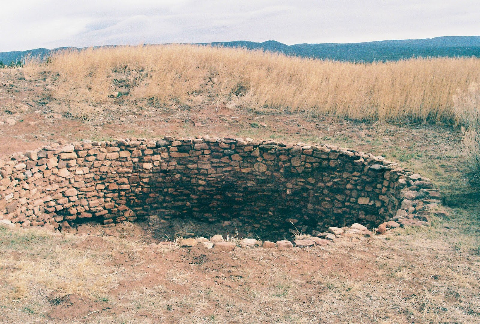
I set out from Santa Fe last Monday morning(3/14/11) to fish the Pecos River. I had been dissuaded from my original plan of Villanueva State Park by the guy at High Desert Angler, so I was headed somewhere upstream from the town. It was cold and overcast. So I decided to kill a little time and visit the ruins at Pecos National Historic Park. I had given some thought to fishing there. There are three beats,no more than three persons per beat per day. The cost is twenty dollars plus your three dollar admission to the park. I had decided against it, mostly because I hate to pay to fish,but also because that helpful fellow at High Desert Angler didn't seem to think it was particularly good bet either. When I arrived at the park, at the counter I was immediately asked if I was a fisherman. It must be my Orvis hat, I thought. Then I explained my decision not to fish, and was only there to visit the park . After I paid I turned around to see several fishermen milling about waiting for instructions from another NPS employee. This reaffirmed my decision- I surely was not going to pay to fish with other people. Anyway,I watched the little movie, walked the walk,took a bunch of pictures and went on my way after about an hour. Very little is excavated here,except for the church complex. There are a couple of reconstructed kivas to climb down in to - which is a nice touch as well.It's a beautiful setting: the wide river and creek valleys, the high pine clad mesas,with the snowcapped peaks in the distance.The church ruins aren't as impressive as the Salinas Pueblos, but then again this one's not out in the middle of nowhere. This was enjoyable side trip, so if you're in the area, by all means check it out.

Saturday, March 19, 2011

Rito de los Frijoles-Bandelier National Monument


I tried fishing here two summers ago but the water was low, the air temperature hot and the section right above Ceremonial Cave didn't have seem to have many fish.This time I drove out to the Ponderosa Group campground on NM 4 and hiked the mile and a half trail to get to the creek about 6 miles further upstream. Beware: the last segment of this trail goes more or less straight( well not straight at all actually,but very little horizontal distance is covered) down using many switchbacks, which it means it's straight up on the way out. My time going in was about a half hour.My time going out was about 40 minutes, and I was chugging both ways( for me). It's a different world down in the canyon bottom here from the drier ponderosa forest at the visitor center. Instead there is spruce and fir along the stream and on the north facing slopes, and even though it was winter,I could tell there's a myriad of deciduous vegetation lining the creek,which would provide more cover in the summer,but it would make it virtually impossible to cast( it was difficult enough as it was). I fished this little mountain brook for an hour and a half, catching 3 small rainbows and one very small brookie. It was fun,but I wish I could have stayed longer. It was another tip of the tongue taste, which can get old after awhile. It would be great to hike in here or at the trail that makes a crossing even further upstream and do a shuttle hike. I guess a loop is possible too, with a couple of miles of road walking. IMPORTANT NOTE: this stream may no longer have fish due the fire and floods in the summer of 2012. Check with the Monument regarding conditions.

Labels: ,

Thursday, March 17, 2011

Bandelier National Monument-Falls Trail


On my third and fourth visits to Bandelier, I got to do two things I've been wanting to do for awhile: visit the two waterfalls on lower Frijoles Creek and fish for trout in the cool forested canyon of the upper reaches of that same stream. The hike down to the falls and then to Rio Grande is a true New Mexico classic. I can't imagine a walk in heaven would make me any happier. Starting off in a pine forest, the trail down gradually winds its way through the narrow valley cut by this small stream. Passing by ( but without seeing at first) the upper falls, there is an abrupt change in vegetation. Large specimens of Mormon Tea border the trail which is now incised into the cliff as it switchbacks down to the stream. Once on the bottom, a true desert riparian garden is encountered with ash, cottonwood, and willow( I know it was still winter, but I was using my imagination).There is an absolute quiet upon reaching the river, while I stop to admire the redrock cliffs and the aprons of sometimes huge basaltic boulders that decorate the hillsides. The river is green, opaque and cold as it flows noiselessly on.Back up at the visitor center, I tuck in to large order of well deserved french fries from the cafe. Wonderful afternoon. IMPORTANT UPDATE:Bandelier has been hit severely by fire and flooding over the last 3 years. The landscape I hiked in may be vastly altered


Labels: ,

Wednesday, March 16, 2011

Gila National Forest - Silver Creek Road


From City of Rocks, it's easy to access the southwest side of the Black Range, also known as the Mimbres Mountains. We crossed the Mimbres River and continued on the well maintained Royal John Mine Road which winds along past ranches and a few spectacular vacation homes. Eventually it crosses onto Forest Service property and shortly after there's a turn-off on the left for the county maintained Silver Creek Road. The first couple of miles are a little rough, but passable for most vehicles. We parked at the first old miners cabin and went on foot, encountering more old structures as we went. These others were a bit too elaborate to be miner's shacks. They may have been some sort of hunting lodge or perhaps a residence, but definitely of a more recent era. We continued on a side road which led to a mining area, then backtracked to the main road which winds along the hillside. It was mostly easy walking, with one steep pitch.We didn't make it to the end of road where one can connect with the Silver Creek Trail, which descends from the Sawyer's Peak trail on the crest, and to the Spring Canyon Trail which begins on NM 152. Nice views,  lovely weather and a few patches of snow in this desperately dry year. I'm still wanting to do a shuttle hike from Emory Pass through this intersection and out the Spring Canyon Trail to the upper Gallinas. IMPORTANT UPDATE: parts of this hike  are within the Silver Fire burn area and are most likely altered from the description here. (June, 2013)


Labels:

Tuesday, March 15, 2011

City of Rocks State Park-New Mexico


We camped at City of Rocks. As we walked around the park,we reminisced about all the different spots we've camped in, and all the good times, and misadventures as well, we've had over the years.This was second place we visited on our first trip to New Mexico, and it's been a regular winter camping spot since we bought our little teardrop trailer 6 years ago. It can be windy. It can get crowded( though usually not in winter), but the stars are wonderful and wandering among the rocks always makes me feel like a kid again. A great place to relax and really enjoy a sunset.


Labels: